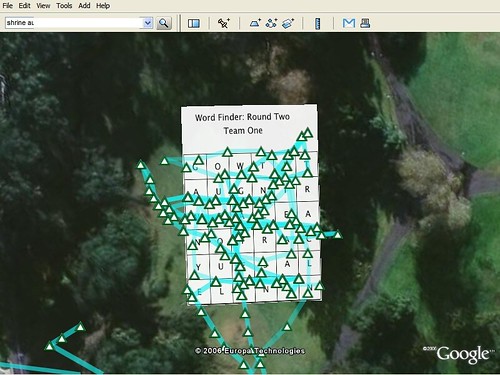
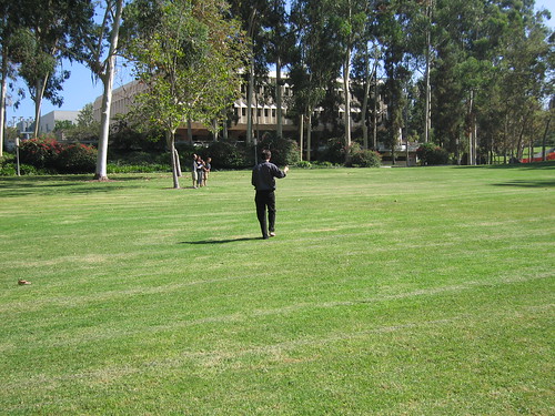
This is a 1st Life / 2nd Life game that is based on paper-based word-finder games. In this game, you try to identify dictionary words within a grid of letters and circle them. In this variation, the landscape becomes the game grid and you have to walk (or run!) to generate a virtual line that runs through the letters in order to “capture” the word and score points. A GPS is used to help the team identify where the letters are in 1st Life space, and to “capture” the words composed of those letters by recording “track logs” through them. The GPS is able to record where you are in 1st Life, and to create “tracks” of locations, which are essentially connected points that make up lines on the GPS. These track logs can be seen as a way of geospatial drawing — the tracks you make delineate lines which can compose various forms of drawing. In our case, the lines are meant to create lines through the letters that make up the words. (Note that in the more traditional word finder games one circles the letters — that would be a bit tricky in this variation, so we’ll just draw an approximate line _through_ the letters.
Teams start with a traditional word finder grid. The grid contains words up, down, diagonal and backwards. The challenge is to identify the words and “capture” them by physically tracing their corresponding locations in 1st Life as quickly as possible.
Each team has 10 minutes to identify the words on paper, and then 20 minutes to “capture” them. The team that captures the most words in the shortest time “wins.”
The game takes place in Aldrich Park at UC Irvine, part of the UC Humanities Research Institute’s “Technofutures” Symposium.
Suggestions
1. It may be helpful to identify the corners of the game grid to help you geospatially orient in 1st Life. Translating the game grid on paper to real space can be tricky!
2. Extracting GPS tracks from a Garmin GPS isn’t hard, but it isn’t easy, either. I used GPSBabel, a smart cross-switch between all kinds of geospatial data dialects.
For example, here is how I used GPSBabel for a class project in order to extract students’ track logs from their GPS’s:
gpsbabel -t -i garmin -f /dev/cu.KeySerial1 -o kml -F ~/Desktop/CTIN405/gps_6.kml
-t instructs GPSBabel to extract the tracklog only
-i specifies that the input device is a Garmin
-f specifies the input “file” — in this case the device is actually the Keyspan serial adapter connected to my Macintosh — your precise device will almost certainly be different, depending on your computer, operating system, and how you connect the Garmin device to your computer
-o indicates that the output type, in this case a Google Earth KML file
-F specifies where I want the output file saved
On my computer I had to run this as a privileged (root) user in order to access the device. There’s a GUI for GPSBabel, but it was wonky and would say it was done when it hadn’t done a thing. I like the command line, I guess..
Technorati Tags: electronic games, Google Earth, GPS


