To The Accessory Crap Heap

Tuesday June 23, 07.53.59

Yes, an old original iPhone car charger and…what’s this? The iPhone 3Gs cannot take the same charging accessories as the iPhone original!? So..basically the introduction of something new forces something old to be tossed out? Maybe there’s something that can be done with the old charger, but, I mean…really? Is this “Good Design” or adhering to those Green sensibilities that Apple is so often associated?

Think not.

Epic Fail. Epic, epic fail. I’m slack jawed. Shocking.

Why do I blog this? Something is always wrong. The whole smash barely works, seriously. It’s not uncommon to get Apple fetishists asking me why Nokia does not do things as cool. There are all kinds of good and bad reasons. But, one of the good ones that makes the most sense to me is that Nokia has to design compatibility (which it does not always do well, to be honest) across hundreds of its factories’ products, and with so much stuff out in the world that, every year if you put them all end-to-end? They’d wrap around the world more than once. But, if you make three or so phones and you can’t get them all to use the same charging specifications? That’s just really bad. Imagine, every upgrade has someone tossing some entirely opaque hunk of plastic and electronics into a bin.

(Oh yeah. Rem Koolhaus’ wonderful Delirious New York: A Retroactive Manifesto for Manhattan is about the only happy thing in this photo.)

Continue reading To The Accessory Crap Heap

Designed for Transparency

New York City.

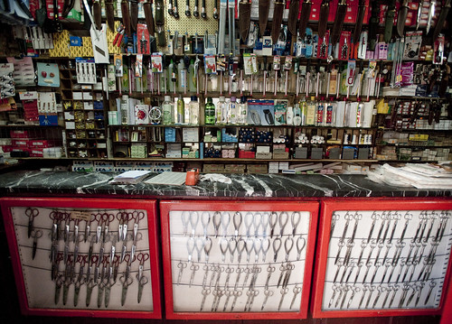
Knife shop. Madrid, Spain.

Two curious examples of “everything-ness.” The first is this “Everything Electrical” company which does, well — everything having to do with electrical installations and so forth. They also have these interesting trucks which are made to be easily loaded and off-loaded at work sites or at the warehouse. I like this design, where the “black box” of the normally closed, obscured truck is opened from three sides. Transparency and efficiency of some sort are in effect here. There’s something quite intriguing about this. Similarly, the knife/scissor/tool shop found in Madrid attempts a similar sort of draw, showing all the fascinating kinds of cutters and so forth are displayed in the open, behind glass and in enormous, visual assortment.

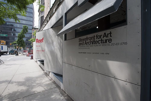
Storefront for Art and Architecture, New York City.

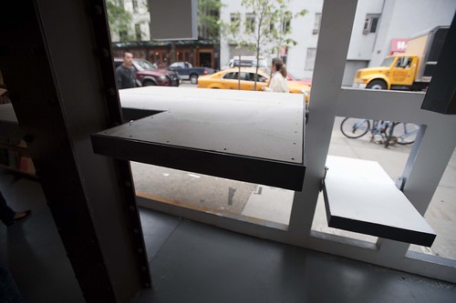
Finally, the intriguing architectural frontice of the Storefront for Art and Architecture in New York City, with its mechanisms for opening itself up to the street in an atypical manner, with flaps and square portholes raises this question itself. What are the ways that digital contexts can learn from the physical mechanisms of transparency, openness and an ability to draw people’s attention in creative ways? How does openness and transparency translate to frankness and trust.

Why do I blog this? Some visual examples of different strategies for creating physical transparency, something that is strangely absent in digital contexts. Things are either there in front or have to be rooted around for — the “storefront” metaphor in a digital setting hits a number of, err…brick walls when translating these settings. The question here to consider are strategies and tactics for creating digital forms of transparency and display.

Continue reading Designed for Transparency

Design Leadership — How Design Thinks?

31102008_192058_009

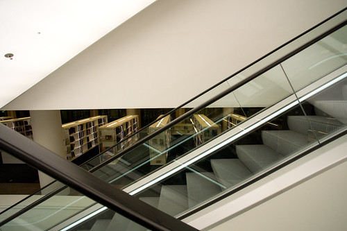
The new Amsterdam Public Library.

A short piece by RISD VP of Media + Partners Becky Bermont in the Harvard Business Review Blog describes her experiences learning about the way design can contribute to how business does what it does. Despite the reference to designers as “experience perfectionists” who want to arrange the music in a room to enhance a meeting that will take place therein (wtf? makes designers sound like flouncy dandys or something), the sensibility of the short piece is to think about design as an active, leading contributor to business strategy. The heart and soul of the larger challenges we think about here at the Laboratory are in the right place in Bermont’s note. It ends with the necessary short-question style pitch to businesses to perhaps come to RISD (as, evidently, Target does on a regular basis) to consult on how design can shape what the business does and how it does it. All good stuff. Read it here.

Why do I blog this? Always on the look out for these sorts of things, looking for some substance and arguments and good-points on this topic of design leadership. What is it? How does design contribute from the start and take charge of how to create more sane, habitable worlds. Continue reading Design Leadership — How Design Thinks?

Innovation 2.0?

Thursday April 09, 15.19.14

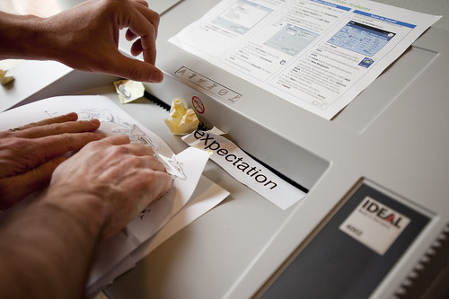
Expectation or anticipation? In Batvik Finland?

An interesting article in the Harvard Business Review that I came across recently. It is relevant to a long-standing interest in other strategies for “innovation” particularly in commercial enterprises.

The article is called “Fewer Engineers, More Anthropologists” by Navi Radjou. It argues for, like…more anthropologists and fewer engineers while an enterprise attempts to “effectively identify[ing] and address[ing] the explicit and unmet needs of the broader consumer base in emerging markets.” (Quick translation — selling more stuff that makes sense to local people/cultures/practices in Brazil, India, South America and probably Africa, too.)

Why I find this intriguing is how ancient it sounds. If it the article was dated in 1990 I might understand. But it is quite recent, published only this month. This makes me think that something was forgotten, as is the nature of history. This is fine, except along with what was forgotten goes any lessons or insights learned.
Continue reading Innovation 2.0?

Urban Historical Infrastructure Layers

Tuesday June 16, 10.30.48

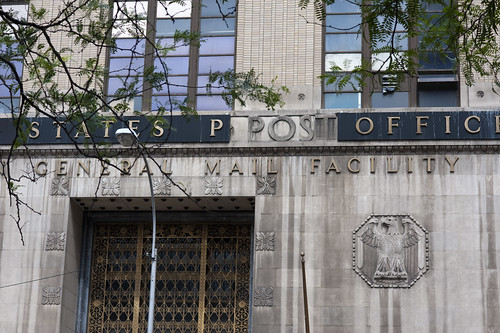
A strange reveal within the historical layers of this New York City post office building. Changes in typography standards forced the new layer? Found here.

Tuesday June 16, 14.30.08

Another form of layering within the infrastructure and architecture of the city. A new bit of building fitted upon the old. In this case, some fancy condo module plopped on top of an older light industrial building in Brooklyn, err….DUMBO.

Wednesday June 17, 16.05.28

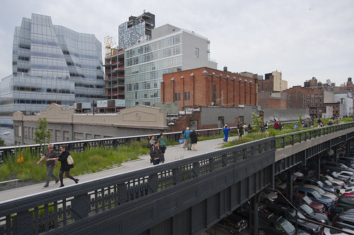
NYC Highline Park evolved from an old abandoned stretch of train track that sits one story above the ground. An elevated light industrial infrastructure repurposed for public and pedestrian usage. Found hereabouts. Still a very delicate, very monitored thing. Feels more like walking about a museum exhibit (don’t step there, for godsake! what’re you doing! stop that..!) than a park. Partially understandable, sure, but like china still which turns it from a park into something else.

Three curious examples of a kind of infrastructural sedimentation, found in New York City and Brooklyn. The first one shows a broken portion of a (ugly) sign that had been placed over the original art deco style lettering on a behemoth post office. The next is a (ugly) fancy condominium module that has been plopped on top of an old light industrial / warehouse building in the now Tony / over-the-top section of Brooklyn’s “DUMBO” (down underneath the manhattan bridge overpass) section. Finally, The Highline, a new urban park that was found within an old abandoned stretch of train track that sits one story above ground, along the westside of Manhattan, around Chelsea-ish.

The first example of the Post Office signage feels like one of those things where an old infrastructure is long forgotten and is then revealed and someone in the office of infrastructure, or probably a local resident with a civic interest says — hey, that old art deco chiseled into that building? It’s historical! And, it’s cool type. Lets reveal it all! And someone writes a little pithy, clever blurb in the “Around Town” section of the New Yorker, interviewing someone from the company that’s going to remove the old sign. I’d put a fin down saying that’s what’ll happen within the next 2-3 years. There’ll be some revival of sorts to continue this tendency in NYC of rehabilitating and making more habitable the city and its views. In any case, the layers here are quite a stark contrast it seems. I wonder why the sign was put up in the first place. Maybe it was easier to let the sign be dirty, as it inevitably will become from the street exhausts and so forth, because of its dark background.

This second example of historical and material sediment in Brooklyn shows a Continue reading Urban Historical Infrastructure Layers

Street Mountain

Friday June 19, 17.24.46

Seen here while enjoying a cooling gelato (mix of mango, pear and passion fruit) with friends in the West Village after a successful day of Urban Scout Adventures.

A curious urban mountain or boulder of some sort. I think there’s a story behind this concrete lump, but I’m not 100% sure. It could be some sort of street furniture, or perhaps an accident that occurred while concrete was being poured and no one cleaned it up?

Street Furniture

Wednesday June 17, 15.04.24

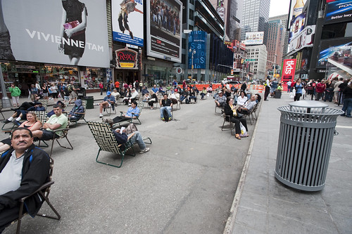
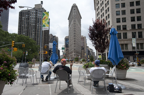
Times Square beach, complete with tourists (as any beach should), found here.

Friday June 19, 12.10.57

Urban Lounge found near Madison Square, New York City.

This is probably old hat for current New Yorkers certainly, and something that makes visits home really interesting, these street furnishings and people zones are incredible interventions and nice experiments about alternative urban landscaping. When arriving in Times Square with my brother for a quick screech through of High POV shots, we managed to get one of these curious middle-of-the-avenue parking spots so you basically park right smack in the middle of Times Square. Which is good because you cannot drive through the square itself, only around it, because of these pedestrian urban “beaches”, complete with lawn chairs. According to one of the local business improvement district rangers or whatever they are, tourists quite like it. I wonder if locals find these useful or an annoyance to their conveyance around the city.

Tuesday June 16, 10.28.00

Saturday April 25, 10.07.27

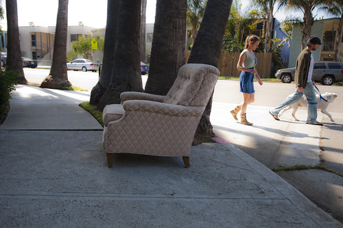
Not quite the same, but in a different category of street furniture — the dispensed with sort.

Why do I blog this? A fascinating example of a reconfiguration of the canonical gridded city. Turning pavement into a more human, habitable space that evokes other leisures is a fantastic way to create new opportunities and to think about new sorts of design practices for urban space. This is an area that many people are curious about of course, and it is something that has attracted the attention of the laboratory quite a bit recently. For some reason, we have been thinking about new kinds of principles, rituals and scouting toolkits for finding new ways to look at the city, using these to think about new kinds of interactive urbanscapes…and not interactive in the “UX” sort of digital-y way. Playful interactions, thoughtful interactions — new rules of occupancy; new social interaction rituals.

GPX to DXF – Drawing GPS Tracks

Sunday March 29, 13.25.20

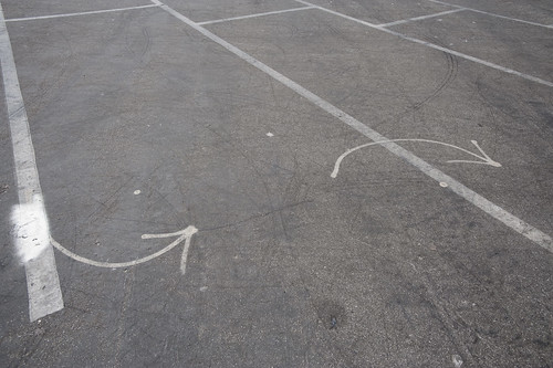
Lines and arrows and splines point the way. Taken in a parking lot near the beaches at Santa Monica.

It has not been a quiet couple of days here in the Laboratory. Lots of gear and glassware about. Goggles, bunsen burners and all that sort of thing. And the report draft was just finished with Nicolas Nova, which occupied many early mornings. We almost spilled an organic, but toxic material on the draft which cause a collective gasp, but it was pulled out of the way, just in time before irrevocable damage was done. We’re writing with ink and pen these days, which feels so much more angelic and respectful, but are, through incidents like this, reminded that such may have nostalgic integrity, but it is also quite delicate and precious.

In the midst of all that was the need to translate a GPS track from GPX format to DXF. This was harder than I thought it would be, at least after poking around the Google. There are some tools that’ll do format conversions and so forth, but they were way more expensive than I thought was reasonable, seeing as we’re not making precious objects. It’s basically a translation of one connected graph format to another.

Okay, so — it was time to think about making our own tools, which took 10 times less time than the original set of Google searches, mostly because of the recently discovered ancient treasure of a Java library our buddy Tom Carden wrote back in the Precambian of the Age of the Network — somewhere’s around 1996 or some such…

This library provides enough functionality to read a GPX track and draw it on screen. The Processing.org DXF library can spit that drawing from the screen out as a saved DXF. So, that basically solves the problem. The DXF files that come out are flat lines that can then be serviced by other software to do other things. (There also exists this Kabeja library for consuming DXF and creating DOM models, which we’ll save for another day.

My lead toward the Carden code was found here on the Processing.org forums, where I found enough of a simple code snippet to get me out and through the chiseled hole in the brick wall I had hit.

Also to note is the small comment in the small simple bit of code that can cobble together many separate GPX files (tracks from a GPS) into one larger one, which can be quite convenient.

Why do I blog this? Mostly for my own recollection and notes as to how things are done. It’s been enough time in the jungle of small, utility challenges that, when on another project inevitably in the future, some small task I need to perform smells familiar — but, why? One gets the feeling — I’ve had to do this before? What project was it? How did I do it? Playing in the geo/map-making/cartography space has all these little formats and translation steps that are a bit zany to wrangle. Jotting a post with a bit of a reminder helps. Te bigger “why do I blog this?” has to do with using real-world GPS tracks as a basis for constructing other things — the input is movement in the world, an effort to figure out how a map might look that inverted the assumptions about static geographies and fluid movement, so that the ground moved and the things that moved became static. *shrug*


import processing.dxf.*;

// Based on Tom Carden's code and GPX library available at
// http://www.processing.org/hacks/hacks:gpx
// Press "R" and your track gets saved as a DXF file which
// you can use in lots of other things..

import tomc.gpx.*;

GPX gpx;

GPXTrack track;
GPXTrackSeg trackSeg;
String trackName;

double minLat, maxLat;
double minLon, maxLon;
double minEle, maxEle;
boolean record = false;

final static int SEPARATOR = 200;
String filename, filepath;

// I collapse lots of individual GPX files into one larger file
// using the free gpsbabel.
// At the command prompt (the GUI editions don't have enough features
// to do this) you'll do something like this:

/************

/Applications/GPSBabel+-1.3.5/gpsbabel -i gpx -f 20090321.gpx 
-f 20090401.gpx -f 20090402.gpx -f 20090403.gpx 
  -x transform,wpt=trk,del 
  -x radius,distance=5,lat=34.0236,lon=-118.4319,nosort 
  -x transform,trk=wpt,del  
  -o gpx -F foo.gpx

The "-x" filters do a couple of things.
The first -x filter turns the tracks into waypoints to work around
an issue that gpsbabel has with the "radius" filter
The second -x filters the output only to points that are within a
5 mile radius of the specified lat/lon, which is useful if you want
to limit the range of data you draw.
The final -x filter turns the waypoints back into tracks, which is what we want
Finally, we output as GPX formatted data and
write the whole thing to the file called foo.gpx.dxf


*************/

void setup()
{
  // Yep, hardcoded path to the GPX file we'll process
  filepath = "/Users/julian/Desktop/GPS Tracks/foo.gpx";
  // We'll use the name of the file for our DXF output, with the ".dxf" extension added
  filename = (new File(filepath)).getName();
  size(800, 800, P2D);
  gpx = new GPX(this);

  // you can load a file or a URL evidently..
  gpx.parse(filepath);

  // Find scope of track file so we can scale our drawing
  minLat = 2000; minLon = 2000; minEle = 100000;
  maxLon = -1000; maxLat = -1000;

  println("track count "+gpx.getTrackCount());
  for(int j=0; j < gpx.getTrackCount(); j++) {
  track = gpx.getTrack(j);
  println("track size "+track.size());
  for(int k=0; k<track.size(); k++) {
     trackSeg = track.getTrackSeg(k);
     println("track seg size "+trackSeg.size());
  for (int i = 0; i < trackSeg.size(); i++)
  {

    GPXPoint pt = trackSeg.getPoint(i);
    if (pt.lat < minLat)
    {
      minLat = pt.lat;
    }
    if (pt.lon < minLon)
    {
      minLon = pt.lon;
    }
    if (pt.ele  maxLat)
    {
      maxLat = pt.lat;
    }
    if (pt.lon > maxLon)
    {
      maxLon = pt.lon;
    }
    if (pt.ele > maxEle)
    {
      maxEle = pt.ele;
    }
  }
  }
  }
println("Lat: " + minLat + " to " + maxLat);
println("Lon: " + minLon + " to " + maxLon);
println("Ele: " + minEle + " to " + maxEle);
}

boolean hasDrawn = false;

void draw()
{
  if(record == true) {
    beginRaw(DXF, filename+".dxf");
    hasDrawn = false;
  }
  if(hasDrawn == false) {
  background(255);
  //stroke(#FF0000);
  //line(0, SEPARATOR, width, SEPARATOR);

  double distance = 0;

 for(int j=0; j < gpx.getTrackCount(); j++) {
  track = gpx.getTrack(j);
  //println("track size "+track.size());
  for(int k=0; k<track.size(); k++) {
     trackSeg = track.getTrackSeg(k);
     //println("track seg size "+trackSeg.size());
       GPXPoint prevPt = trackSeg.getPoint(0);
      PVector prevPos = GetPosition(prevPt);
      for (int i = 1; i < trackSeg.size(); i++)
      {
       GPXPoint pt = trackSeg.getPoint(i);

    // Show track
    PVector pos = GetPosition(pt);
    stroke(#FF8800);
    line(prevPos.x, prevPos.y, pos.x, pos.y);
    prevPos = pos;
  }
  }
 }
  }
  if(record == true) {
    endRaw();
    record = false; // stop recording to the file
    println("done writing "+filename+".dxf");
  }
  hasDrawn = true;
}

void keyPressed() {
  if (key == 'R' || key == 'r') {
    record = true;
  }
}

PVector GetElevation(int n, GPXPoint pt)
{
  return new PVector(
      map(n, 0, trackSeg.size(), 10, width - 10),
      map((float) pt.ele, (float) minEle, (float) maxEle, SEPARATOR - 10, 10)
  );
}

PVector GetPosition(GPXPoint pt)
{
  return new PVector(
      map((float) pt.lon, (float) minLon, (float) maxLon, 10, width - 10),
      map((float) pt.lat, (float) minLat, (float) maxLat, SEPARATOR + 10, height - 10)
  );
}

Embodied Viewing Platforms

Here and There a cartographic experiment by Shulze and Webb.

I think I figured out why I enjoy this map by Jack Schulze and Matt Webb — it can possibly induce vertigo, which means it’s human, real and embodied. The rolling coasting perspective that deliberately distorts the island of Manhattan shows the city from a fixed point of view, but still showing no horizon. The map is not these flat views that we’ve become so accustomed to, floating above the ground but yet firm, and sure and secure. A little more awkwardness in points-of-view is called for, I think.
Continue reading Embodied Viewing Platforms