“Grand Theft Auto V” level design

Fantastic article about "Grand Theft Auto V" level design. It's a very interesting account of their process with "location scouts, architectural historians, off-duty police, DJ Pooh and our own research team." The description about how they dealt with light as well as the diversity of geographical signifier Some excerpts:

"Our process has been to block the world in quickly and then collate our reference and build out each part till we hit a good visual bar and a reasonable level of solidity. This is probably where in the past we would have stopped and finished off. Instead, we have done pass after pass of refinement for all sorts of reasons. Simply, does it look good enough? Does it play well enough? Does it feel distinctive? Does it sit well with its surroundings? Does it get across the character of the area we’re trying to create? How does it sit in terms of vistas and general sculptural composition? Do we need more color, contrast, branding, or lighting? Does it feel weathered? Does it have a sense of place and history? Can we layer story over it, whether through ambient, “generalized story” (who lives here, what have they done to the place, who lived here before them, where do they shop, what do they do for fun, do they keep their garden nice, do they have a fetish for gnomes and pink flamingos?) or whether it’s layering our actual story over it: mission detailing, filling out areas that belong to characters, random events or beats, and random characters you might meet. We take all the elements the story and mission guys add and layer more detail over the world based on it. [...] I know there are bigger games out there geographically, but I don’t think there are in terms of content. I want to stress that not only is this world huge but it’s absolutely handcrafted. Every little bit of this world has had a large number of extremely talented artists pore over it. There’s always something to discover, something weird or interesting to see or interact with. It’s absolutely not a massive, empty world. We’ve considered the placement of every tree. We’ve simply not copied buildings around the map or procedurally generated the terrain to pad it out. It’s all handcrafted, all unique, and we’ve gone over it all again and again and again to make sure there’s enough layering of detail that I don’t think many people will ever see everything we’ve put into the world. That in itself, though, means that most people will have different experiences."

I also love the way they understand the complexity of spatial experiences ("Even elements like the radio and their ads have an influence on the map.") and use these kinds of tricks in the game. Why do I blog this? Fascination towards the recreation of Californian space and the way it's addressed to engage players.

Representing the city as it’s lived: livelihoods

It’s been few days that I’m following the the livehoods.org/ and it’s quite interesting.

The project is defined as follows:

Livehoods offer a new way to conceptualize the dynamics, structure, and character of a city by analyzing the social media its residents generate. By looking at people’s checkin patterns at places across the city, we create a mapping of the different dynamic areas that comprise it. Each Livehood tells a different story of the people and places that shape it.
(…)
The hypothesis underlying our work is that the character of an urban area is defined not just by the the types of places found there, but also by the people who make the area part of their daily routine. To explore this hypothesis, given data from over 18 million foursquarecheck-ins, we introduce a model that groups nearby venues into areas based on patterns in the set of people who check-in to them. By examining patterns in these check-ins, we can learn about the different areas that comprise the city, allowing us to study the social dynamics, structure, and character of cities on a large scale.

Why do I blog this? Working on a similar topic, I quite enjoy this kind of research work. The idea that social media data can be employed to understand areas as lived by people is fascinating and highly intriguing to test. It’s somehow what one can call a “social map” and we now have more and more data to see how it would look like.

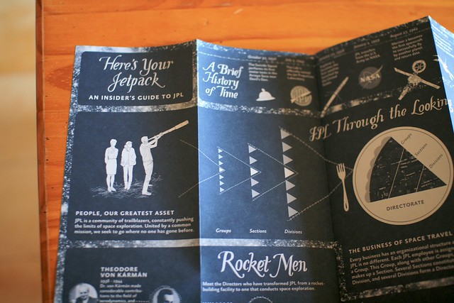
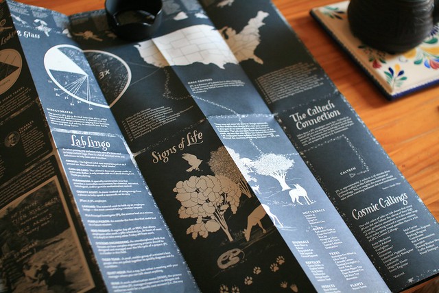
Mysteries and Curiosities map of NASA Jet Propulsion Laboratory

Two weeks ago, when in California, Luke Johnson gave me this fantastic (and sort-of psychogeographic) map of NASA Jet Propulsion Laboratory. The project is called “Mysteries and Curiosities Map of JPL: How can design influence an established culture?” and it has been conducted by Luke and a bunch of other people.

As described by the website, “The map functions as a tool to orient new employees, encourage Lab explorating for current employees, and to put a human face on JPL for the outside public“.


As described by Luke:

For a place that depends on logic and reason, the Lab’s layout is anything but. In fact, a running joke at JPL is that its employees need to use GPS to find their way around the Lab. For one, buildings have numbers instead of names. Secondly, buildings are ordered in the number in which they were funded, instead of by location. For example, Building 67 is perplexingly located between Buildings 238 and 138.

Intrigued by this dichotomy and wanting to know more about JPL aside from the four walls of my cubicle, I came up with a plan. Armed with a GPS tracking device, camera, and a trusty pair of shoes, I walked to every building on Lab in numerical order. What I thought would take a Saturday afternoon took 22 hours over the span of four days at a walking distance of 52.2 miles.

The resulting map is a reflection of this wacky experiment, research at the Lab’s Beacon Library, and conversations with other JPL employees. The map itself is divided into two sections. The front is an Insider’s Guide to JPL, containing information I wish someone had explained to me when I began working at the Lab.

Why do I blog this? Having been to CERN yesterday morning with the Lift12 speakers made me realize how such maps of big research facilities can be relevant as a way to not only describe spatial material but also stories and cultural content related to these intriguing places. Quite a nice project!