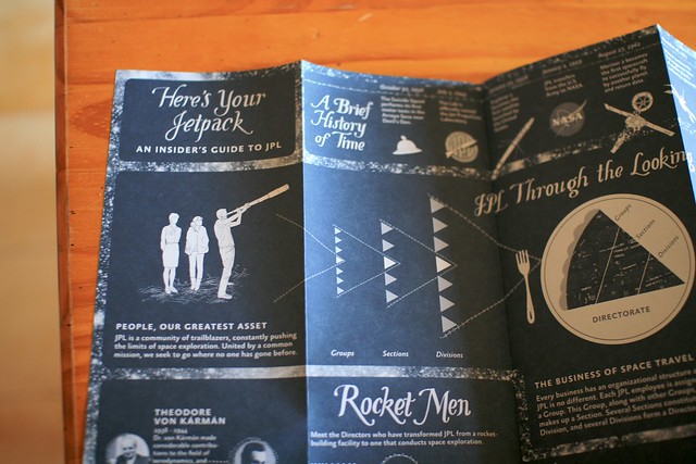
Two weeks ago, when in California, Luke Johnson gave me this fantastic (and sort-of psychogeographic) map of NASA Jet Propulsion Laboratory. The project is called “Mysteries and Curiosities Map of JPL: How can design influence an established culture?” and it has been conducted by Luke and a bunch of other people.

As described by the website, “The map functions as a tool to orient new employees, encourage Lab explorating for current employees, and to put a human face on JPL for the outside public“.


As described by Luke:
“For a place that depends on logic and reason, the Lab’s layout is anything but. In fact, a running joke at JPL is that its employees need to use GPS to find their way around the Lab. For one, buildings have numbers instead of names. Secondly, buildings are ordered in the number in which they were funded, instead of by location. For example, Building 67 is perplexingly located between Buildings 238 and 138.
Intrigued by this dichotomy and wanting to know more about JPL aside from the four walls of my cubicle, I came up with a plan. Armed with a GPS tracking device, camera, and a trusty pair of shoes, I walked to every building on Lab in numerical order. What I thought would take a Saturday afternoon took 22 hours over the span of four days at a walking distance of 52.2 miles.
The resulting map is a reflection of this wacky experiment, research at the Lab’s Beacon Library, and conversations with other JPL employees. The map itself is divided into two sections. The front is an Insider’s Guide to JPL, containing information I wish someone had explained to me when I began working at the Lab.“
Why do I blog this? Having been to CERN yesterday morning with the Lift12 speakers made me realize how such maps of big research facilities can be relevant as a way to not only describe spatial material but also stories and cultural content related to these intriguing places. Quite a nice project!