When discussing and writing about the future of cities with autonomous vehicles, it is easy to skip over complex details in favor of the “big headlines”.
Any decision-maker serious about evaluating the key opportunities of an idea, investigating challenges and possible complications, must consider the details through-and-through. This is what Design Fiction is good at. It is good at understanding the implications of today’s decisions. It reveals the ways futures could come to life and shows what that looks like in the form of material objects — the tangible artifacts from the future. For example, the creation of a Quick Start Guide for a Self Driving Car reveals a myriad of topics that would need to be addressed to describe how to activate, switch into Uber mode, upgrade firmware, etcetera.
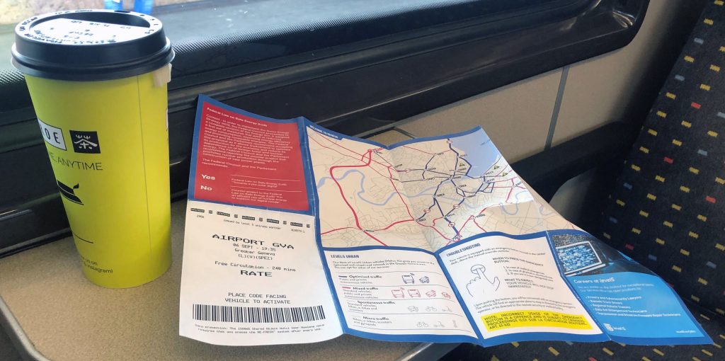
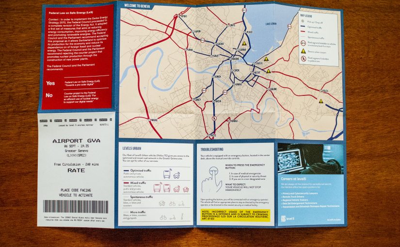
This is the reason why the Department of Mobility at the Canton of Geneva commissioned us to investigate their “what if” scenarios around automated driving. Using our loose Design Fiction process, we selected an artifact that could reveal the implications for urban policy. We wanted a popular artifact, intelligible by a large audience. We created a foldable map of Geneva and brought it back from the future to be given out to the local public or tourists. The point of doing Design Fiction is to create the artifact and going through the work of actually making them — not writing about them. Practically, we loaded OpenStreetMap layers into a Geographic Information System (QGIS) to organize and project the road segment data into a possible future. We iterated several times after discussing the results and using Illustrator to polish the details (e.g. remove road segments, highlight potential consequences) and imagine new legends (e.g. urban canyons, levels of automated traffic).
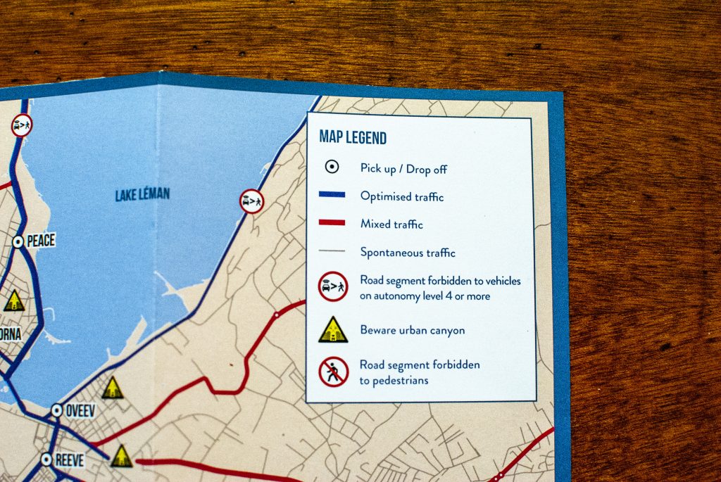
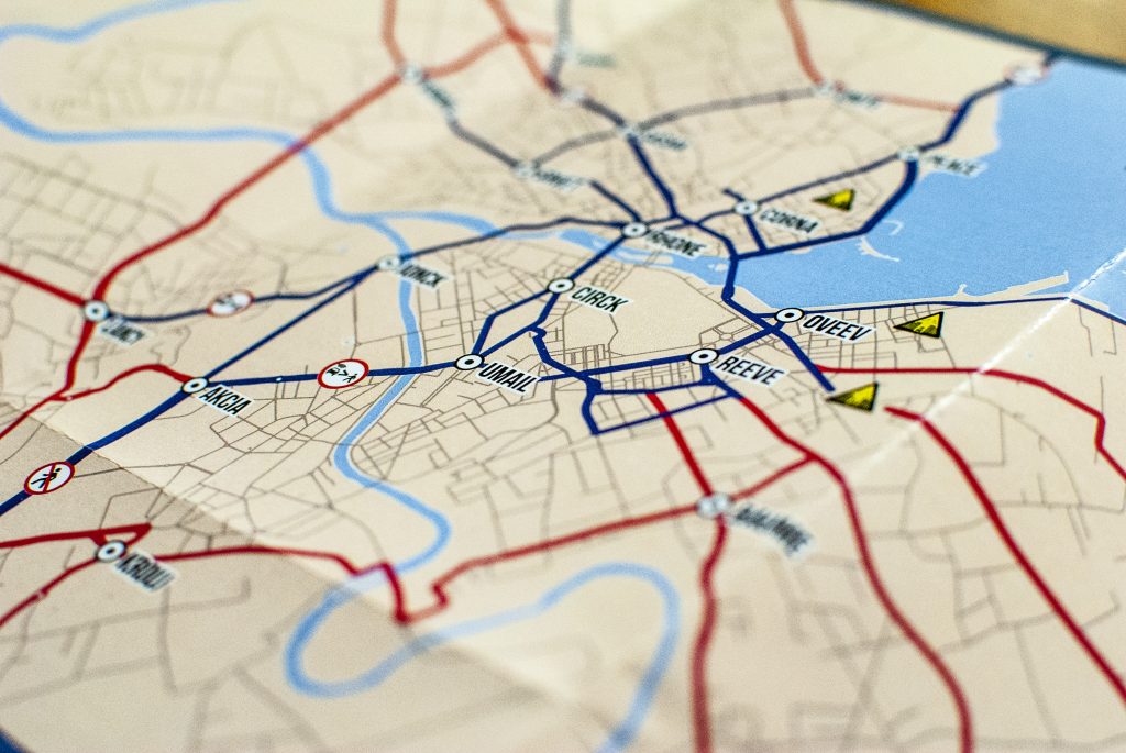
The foldable map format also gives opportunities to add content alongside the actual street plan. We expanded the world-building inserting descriptions of career opportunities, an upcoming Swiss federal vote on the topic and how the system of fleets of autonomous vehicles actually works with its pick-up and drop-off areas. This content hides provocations and simple hooks to generate discussions. The overall result shows how self-driving cars may have an influence on traffic, urban infrastructures and mobility in general.
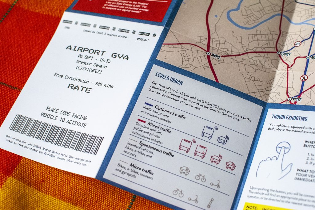
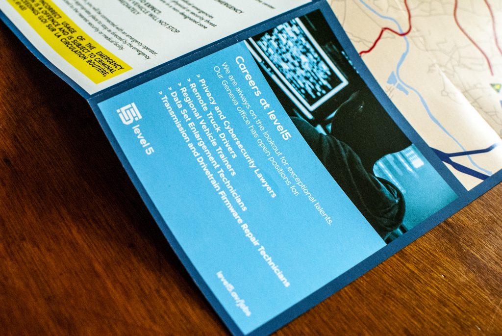
The intention for the Department of Mobility at the Canton of Geneva was to generate debates about the challenges that would be faced, the failures that might occur, the services that might emerge, the new kinds of signage and rules, etcetera. The map was used in the context of a local event about the future of the city, along with a series of talks and workshops on various topics public institutions have to deal with (places for kids, agricultural facilities, urbanism against climate change, etc.). In this context, it acted as a tangible future for a group of people with conflicting opinions to exchange point of views. We found out that the discussion revolves around two main topics : the way urban traffic may be reconfigured and redefine what is acceptable on certain streets (e.g. pedestrian movements, presence of non-autonomous vehicles), and the energy infrastructure needed for this technology to happen.
In this project, we imagined the near future as a territory. Maps provide a popular support to tell us how humans, technology and nature co-evolve. They make you travel to a future without actually going there. They bring a future into the hands of an audience with an objective to better understand the implications of today’s socio-technological developments might have on everybody’s life. Finally, our experiment of mixing today’s datasets with future narratives opens the doors of a new practice that uses techniques in Data Science not to predict what comes next but to speculate on the implications of the work of Data Scientists (e.g. automation, augmented intelligence).
