The Atlas of Desire

Or: privatesquare, ten months later

It would be generous to say that privatesquare was ever released. Instead, the source code was made public with a long and twisty blog post and a flurry of screenshots. I’ve told a few people about my installation of privatesquare but since I haven’t had the stamina to run a service for strangers (and a free one, at that) it’s remained small and reserved for friends and family. A few people along the way have set up their own instances and that’s been both gratifying and enormously useful in working out some of the kinks.

Maybe there are lots of copies of privatesquare running in the wild. I have no idea and no way of knowing. This is not a bad thing. In the meantime, I’ve continued to chip away at the project adding small features and fixing bugs as they come up.

Recently, we moved from San Francisco to New York City. Maybe foursquare, itself, woulda-coulda-shoulda started in another city but once you start to live the day-to-day ritual in New York it becomes pretty clear why it started here. The Atlas of Desire feature, described below, probably would have languished in a pit of good intentions if we hadn’t moved here but I’ll come back to that in a bit.

When it was first announced, last November, privatesquare came with a long list of tricks it hadn’t learned so it’s probably long overdue for a status update.

New old things

Here’s an unordered list of the things privatesquare said it didn’t do went I pushed it out of the nest:

  • History pages

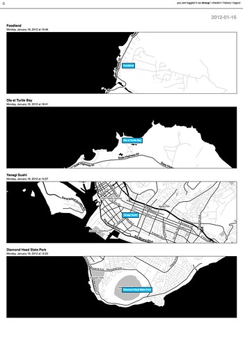
    North shore / South shore (Jan. 16)

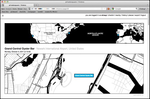
    There are now history pages for venues and dates (and date ranges) as well as for cities. Details on that below.

  • Sync with the foursquare API…

    This is now possible, although it’s not enabled by default.

    Specifically, there is a little script that can be run by hand to import any foursquare check-ins that may have happened outside of privatesquare. This includes the history of check-ins that predate someone starting to use privatesquare. Or not. That’s why the feature needs to be explicitly enabled by each user choosing from one of three options:

    • Do not sync foursquare check-ins – Which is what it says on the tin. What you do elsewhere is entirely your business and privatesquare doesn’t need to know about it.
    • Only sync recent foursquare check-ins – Tell privatesquare to archive missing check-ins but only those that have happened since you signed up (with privatesquare).
    • Sync all foursquare check-ins past and future – This tells privatesquare to archive your entire foursquare history. This is what I’d expect most users to choose but it just always ends better when you let people make that decision for themselves.
  • The nearest linear cell-tower problem…

    Sort of. Not really, though.

    The nearest linear cell-tower problem is caused by the fact that when a person is using privatesquare from their phone they are connected to the Internet through a cellular rather than a wireless network. Since the nearest cell-tower is used as a proxy for your location and since cell-towers have a range that is sometimes greater than the radius used to query nearby venues the list of places that gets returned is sometimes weird and full of bunk.

    One issue is that the W3C geolocation API, used by web browsers to determine your location, doesn’t tell you how your location was acquired. Was it from a wireless network? A cell-tower? A passing drone, overhead? There’s no way to know and by extension no way to adjust expectations.

    The nearest linear cell-tower problem is ultimately a user-interface problem and not one that’s ever been tackled particularly well. In more recent versions of privatesquare there is sometimes a little grey dot (rather than blue) that’s meant to indicate where the code thinks you are and help provide some context for the other dots.

    Another option is to allow you to grow the search radius for each query but I haven’t done that yet. File under: Something, however inadequate, instead of nothing.

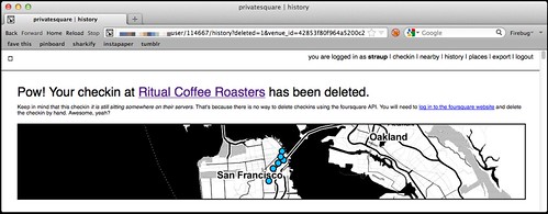
  • There is no ability to delete (or undo) check-ins…

    Done.

    deleted checkins

    Except for the part where there’s no way to delete check-ins using foursquare API which is … puzzling, to say the least. So in those instances where you’ve checked in to both privatesquare and foursquare and then delete check-in using privatesquare you’ll be presented with a short (exasperated) note explaining the situation and a link to the foursquare site where you can finish things up.

    I know, right?

  • There is no ability to add new venues….

    Nope. Still not possible. Chances of it happening remain close to zero.

  • Nor is there any way to record events offline…

    Sort of. Kind of. But only one particular facet of the problem is handled well.

    I first started thinking about this at SXSW this year because the combination of both the cellular network and foursquare being simultaneously overloaded with eager users meant that privatesquare was often unusable in downtown Austin.

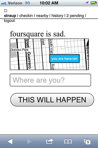
    deferred checkins / work in progress

    There are two problems that need to be sorted here:

    • The first is some way to store a check-in for future use when foursquare API is sad.
    • The second is some way to store a check-in for future use when the network itself is sad.

    The first problem is now accounted for with pending check-ins, something I’ll discuss more in a bit. The second problem isn’t really accounted for at all and at some point I just need to sit down and look carefully at what the Lanyrd kids did for their mobile site and probably just copy that.

  • There is no way to distinguish duplicate venues (same name, different ID)…

    Nope. Still punting on that.

  • Pages for venues…

    Totally!

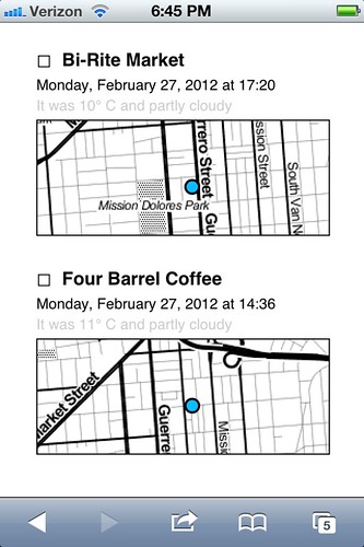
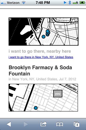
    Every venue you’ve checked in to now has its own page on privatesquare. Each venue page has a list of the dates you’ve checked in there (including links to the actual check-in page), a link to other places you’ve checked in to nearby and a handy I am here now button for … well, check-ing in again.

    (art is your friend)

    Designing for thumbs, and all that.

  • Pages for cities…

    Yes!

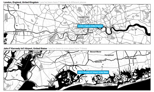
    All check-ins in privatesquare are reverse-geocoded using the Flickr API which returns a list of Where on Earth (WOE) ID associated with a venue. At the moment only cities are recorded so you can’t filter check-ins by neighbourhood or country. Technically, there’s nothing to prevent it from being possible but cities seemed like a good and easy place to start.

    The places pages are kind of great and they are especially striking when you see them on a screen that is bigger than your phone. And because it uses the Flickr API it means that airports are bucketed as cities which makes even more sense in a foursquare context.

    privatesquare starts to get places pages / airport city

    Neighbourhoods are also a near-certainty given that no one’s geo infrastructure can figure out how to make peace with the meta-neighbourcities, called boroughs, that form the NYC metropolitan area and I actually have to suffer the consequences now that I live here. See also: the Atlas of Desire, below.

  • Export…

    Yes!

    There are handy links at the bottom of most pages to export your check-ins as either a CSV or a GeoJSON file.

    Exports are available for the following buckets: check-ins by date or date range; check-ins for a venue; check-ins for a place. Exports should be available but aren’t yet for for: check-ins by nearby-iness; check-ins by desire (more below).

    It has also been the case that if you’re running privatesquare in a controlled environment (like a shared web-hosting service) that enforces its own usage limits exporting check-ins for a user with billions und billions und billions of check-ins can be problematic. I don’t have a ready-made solution for this problem, yet.

New new things

At the same time all of that was being done, there were a bunch of smaller things happening. In no particular order they are:

  • Documentation!

    Gary Gale has done an amazing job of peeling away, with fresh eyes, the stack behind privatesquare and Flamework and keeping detailed notes about what everything means and how to get privatesquare up and running with a minimum of fuss in a variety of environments.

    Gary is also one of those people who checks in every time he exhales so he’s been excellent at finding the crumbly edge of things in privatesquare.

  • Weather tracking

    privatesquare records the weather!

    privatesquare tries to record the weather (based a venue’s latitude and longitude) whenever you check in. Not much is done with that data except to show in the list of check-ins for a venue. The data is stored alongside the check-in so there’s always to opportunity to do something clever and interesting with in the future and in the meantime it makes for a nice soundtrack when scrolling backwards through the history of a place.

  • Time of day tracking

    Sort of.

    Vladimir Agafonkin wrote a lovely little Javascript library to calculate the time pie for a given timestamp and Tom Carden was good enough to create a handy HTTP pony wrapper for it on Heroku that can be poked when a user checks in.

    All your check-ins that happened during the golden hour and that sort of thing.

    Unfortunately, with all the other network requests going out to third parties (foursquare, weather services and so on) the API call to get a time pie is often the one that fails or is killed because it happens so late in the chain of events. For the time being it is not a feature that is enabled by default. There’s a branch of privatesquare with the start of a pure PHP port of the code but it is both incomplete and full of bugs.

    If you’re not familiar with the idea of time pies, you should definitely read this blog post about them from the Stamen kids.

  • Deferred check-ins

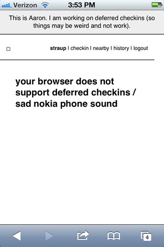
    Occasionally the foursquare API is sad. Sometimes it happens when you’re trying to use privatesquare. In the past you were sorry-out-of-luck but now when that first API call to fetch nearby venues fails privatesquare will give you the option of writing down the name of the venue you were trying to check in to and stick it, along with a timestamp, in your browser’s local (storage) cache.

    Once that happens a link titled pending will magically appears in the navigation menu and from there you can go back in time (sort of) and finish check-ing in.

    Essentially all that’s happening is the usual check-in process being replayed but with a canned search term and a note to privatesquare to use a an equally canned check-in time instead of of right now.

    copy is interface, right?

    For a bunch of perfectly good reasons you can’t do the same in foursquare so any pending, or deferred, check-ins are not forwarded along to the mothership. I may change that in the future and handle the spacetime disconnect by simply adding a note to the foursquare check-in. We’ll see.

    This is basically what should happen when the network itself is down or unavailable. Cities like New York are strange beasts that way. It’s hard to keep the scale of the infrastructure, and the burden of its history, in mind some days. Aside from the fact there are whole pockets of the city with terrible network (read: cellular) connectivity there are others that completely silent, to this day.

    Subways are an obvious place to want to check-in and privatesquare shouldn’t let itself be defeated by the dark spaces underground so teaching the code to play nicely as an offline application is rapidly bubbling up the totem pole.

    I’m told that if you have one of the fancy auto-refilling monthly New York City subway passes it’s possible to retrieve a history of all the stations where it’s been swiped so that bodes well for some sexy Clipper Futures style integration with privatesquare in the not too distant future.

  • The Atlas of Desire

    Untitled

    Let’s be honest. On its current trajectory privatesquare will, sooner or later, become Dopplr. I don’t know what that says about foursquare and since the thing I built is, by design, not social I couldn’t exactly call the Chris Heathcote buckets described in the first blog post a Social Atlas. So, I called it what it is: an Atlas of Desire. Or, in concrete terms:

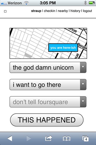
    • Web pages and list view for all the places you’ve checked-in to rolled up by the status you assigned: I am here; I want to go there; again again; and so on.
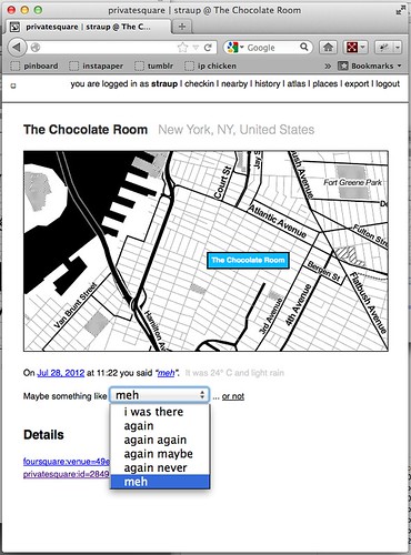
    • The ability to change a status after you’ve checked-in. For example, you could check-in to a restaurant when you sit down to eat and then change to again maybe when you leave.

    I’ve also added a new status simply called meh which, to my mind, is somewhere between again maybe and again never but ultimately the semantics are left up to individual users.

    If you asked me I’d tell you it’s for those places that you would visit for purely mechanical reasons: No matter how lackluster the food is it remains less bad than the bad craziness and temper tantrums caused when you melt down out of hunger.

    privatesquare got a new VERB

    Shelley Bernstein, from the Brooklyn Museum, deserves a proper shout-out for the Idea of Meh which was part of her work making public the museum’s collection metadata.

    In addition to filtering your check-ins by status, you can further prune those places by nearby-iness or by city. It’s become pretty obvious that you should also be able to scope your desire to a neighbourhood. (See above inre: neighbourhoods.) It’s not a hard feature to add but it is a lot of typing so it will happen sometime between this blog post and re-wiring everything to work offline.

Still broken things:

Things that should never have been broken in the first place and that maybe I should fix before I say anything else, but oh well…

  • OMGWTFTZ… timezones

    There are no excuses for this. It’s a thing that conveniently Just Works ® on the West Coast (because that’s the default timezone in the source code) and a thing complicated enough, under the surface, that I’d like to spend a little bit of time thinking about it before I go charging in to fix things.

    Probably the best thing would be to check for the timezone in the foursquare API response when you check-in and store that information locally. Failing timezone information in the API response I might build a simple httpony service on top of the whereonearth-timezeone dataset to do reverse geocoding for timezones.

    Sorry.

Things still TO DO

Untitled

Mike Migurski has requested that privatesquare grow an I’m on my way status flag which is tempting but we’ll have to see about that one. Meanwhile, in no particular order these are some of the outstanding known-knowns:

  • Make the tasteful pale grey permalink button and link for individual check-ins less invisible

    Yes, there are tasteful pale grey permalink buttons and links and for every check-in.

  • Build scripts for “cloud app” hosting

    Gary’s documentation for setting up privatesquare is great and makes the whole process less painful but enough technical hoop-jumping remains to make it all inaccessible to a lot of people. Meanwhile, there are a whole raft of hosted services, like Heroku or PHPFog, that allow you to one-button install web applications which seem like they would be a good fit for things like privatesquare.

    Unfortunately the way the privatesquare is bundled (read: the ways the files and folders are organized) doesn’t lend it to one-button anything with many of these services. privatesquare (and similar tools I’ve been tinkering with at the same time) has never had versioned releases but it might be time be time to start freeze-drying the code at particular moments and creating discrete bundles targeted at specific environments.

    Those releases would always lag a little behind the new and shiny but the up-side is that it would be easier to install, which is probably a trade-off some people would make.

  • Sharing. Maybe? Probably not…

    privatesquare is so-called for a reason. Every now and then I think about changing the default check-in status from don’t tell foursquare to don’t tell anyone which would, once you pulled in a user’s contact list, allow for sharing of things on privatesquare.

    I am still unconvinced about this one as it adds another layer of complexity and it’s not clear why it’s useful (foursquare is pretty good at that side of things) outside of the Atlas of Desire for which plain vanilla exports are probably more important. To whit:

  • Better integration and/or pillaging of the Dotspotting codebase

    A couple months ago I forked the source code for Dotspotting and started to add the ability to edit individual dots. That’s really as far as I got and I’m not entirely sure where it all fits with privatesquare but the shadows of the two projects seem to overlap more often than not.

    Something something something see above something about exports something something something maps something something something.

  • A proper API

    privatesquare already uses its own API but punts entirely on delegated authentication and still uses cookies for authentication and authorization. This is not ideal or, rather, is not a reason to lack an API that third-parties could build on.

    This is just another one of those tasks that requires some time where I sit down and spend the time to finish all the typing necessary to make it happen. Unfortunately, it is a thing made more complicated by the fact that having to read any of the OAuth specs makes me a little crazy in the head. It will happen.

  • Notes

    Maybe. I’m of two minds which is to say I’m not inclined to add notes because I like the simplicity of the site, now, but could be convinced. For a while I had a version of privatesquare that would let you add notes to Findery (née Pinwheel) from venue, or check-in, pages and relied on the magic of machine tags (on their side) to stitch everything back together. I liked that and when there is a public API for the site (in the past I was… well, yeah, anyway…) I will probably slip it back in as an optional feature.

  • Artisanal Integers!

    No, really.

    Privatesquare is at least half the reason that artisanal integers exist at all so it’s only fitting that is should start using them. Dan Catt’s blog post about London Integers is good place to start if you’re sitting there oscillating between confusion and table-pounding muttering the words artisanal… integers…

    Really.

One of the nicest things anyone has said to me about privatesquare since I started building it was: Oh, I’d love to use it but I can’t because I have an Android phone. The nice part is: you can! privatesquare is nothing more than a what-do-you-call-it web application.

The whole native versus web application debate on mobile is interesting, but only insofar as there are still a few tricks that web browsers can’t do or that they are prevented from doing by the operating system itself. Beyond that it all smells too much like the insane and self-serving hair-splitting that people, in the 90s and early 2000s, made about WAP and other uniquely mobile technologies. Read: Small computers, in your pocket.

privatesquare gets a HUD / flying home from Lisbon

privatesquare is meant to play equally well with your desktop as it is your phone. As time permits and I can work through what a print-specific CSS file looks like it should also work on that crazy retrograde technology that refuses to die: paper. The extent to which privatesquare fails, in any of those arenas, is more a reflection of (my) poor design skills than it is proof that somebody’s preferred form factor wins at celebrity death match.

And on and on, it goes!
Weekending 17062012

Here in Los Angeles it’s mostly been programming and book editing and talking to humans. Geoff Manaugh and Nicola Twilley stopped by to do an interview for their curious cross-country mobile blog/interview platform/landscape exploration vehicle called Venue. That was good fun to discuss the various ways landscape, urban space, data-based representations of places, things and flows of humans has informed and influenced the work we do here. Curiously — that seemed to be the topic of the weekend in one way or another. By that I mean that Sunday evening Zoe Ryan and Karen Kice to talk about the same set of topics for a forthcoming exhibition that the Art Institute of Chicago will do. It was a good opportunity for myself — to refresh my memory about a number of projects that sometimes I forget about, like Drift Deck and PDPal. So fun conversation time last week.

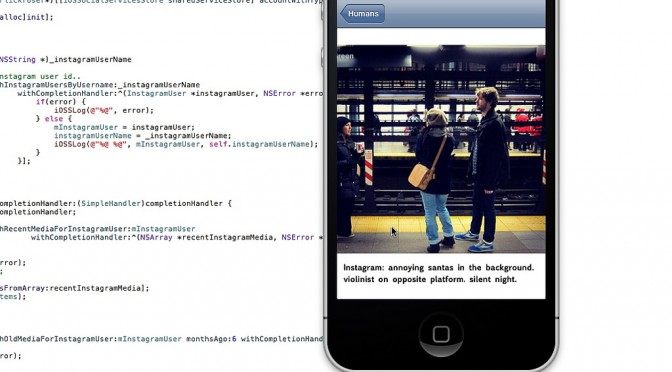
The programming has been good and fun as well. It’s quite nice to get back into that and maintain that skill as well as check off the to-do list a number of ideas and projects that have been lingering. I’m currently working on a little social browser/viewer that inverts the way I “catch-up” with my Friends — other than the “friends” that I find online or who ask me to be their friends but, really? I have little idea as to who they are and often quite a small/nil stake in what they’ve been doing or what they’ve taken a photo of. So, in the app I basically go through the social services for these true-blue Friends and show their latest photos, tweets, etc., so that I don’t have to trawl for them amongst the kruft of illegible feeds and all that crap. I go to people first rather than social services.

And then Rachel Hinman’s new book “Mobile Frontier” showed up with a little interview she did with me. So..that was fun.

Additionally, there’s been more planning and phone calls for this Design Fiction workshop we’ll be doing in Detroit this fall. More about that when I’m not rushing off.

Otherwise..looking forward to the summer with Nicolas here quite nearby in Venice Beach.

Continue reading Weekending 17062012

Pretty Maps – 20×200 Editions

Some of you may have noticed, mostly probably not — but the Laboratory has expanded its ranks. It’s starting to feel like a proper design collective in here. One of the lovely attributes of the people in the Lab are the broad sectors of activity they cover that doesn’t make it seem like they do a zillion different things, but do many things to work though a relatively core set of interests.

Take Aaron Staup Cope. He writes algorithms that tell computers what to do. He makes maps out of paper. He makes maps out of algorithms. He makes you think about the ways that algorithms can do things evocative of map-ness..on paper.

Etc.

What I’ve learned from all of Aaron’s exploits in Dopplr-land, Open Street Maps-land, Walking Maps-land is that maps are dynamic, living things that should never be fixed in their format, style, purpose. They should never be taken for granted — even if the Google Map-ification of the world is doing just this. They should come in a bunch of sizes and shapes and colors and purposes. Etc.

Check out Aaron’s 20×200 Editions of his Pretty Maps. Get yours. I did. LA’ll go on one side of the wall. NYC will go on t’other.

Here’s what they say about Aaron over on 20×200.

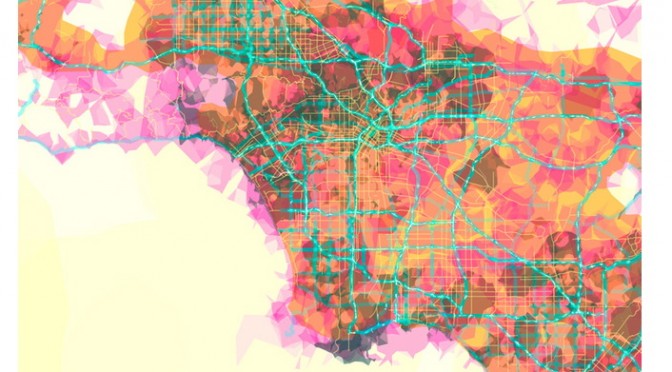
For now, let’s set our eyes West, on L.A. County. Like prettymaps (sfba), prettymaps (la) is derived from all sorts of information, from all over the internet. Its translucent layers illuminate information we’re used to relying on maps for–the green lines are OSM roads and paths, and orange marks urban areas as defined by Natural Earth. They also highlight what’s often not seen–the white areas show where people on Flickr have taken pictures. It’s an inverse of a kind of memory-making–a record of where people were looking from instead of what they were looking at, as they sought to remember a specific place and time.

Interaction Awards 2012: Drift Deck for People's Choice

Drift Deck is up for the IxDA Interaction Awards in the “People’s Choice” category. Which isn’t the “Jury’s Choice” but — whatev. It’s the People, so we’re hustling to make you, the People, aware of this chance for you to choose what is the Choice of the People. For Interaction Design Awards.

Please give it a vote.

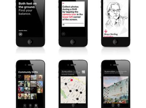
What makes Drift Deck chooseable? Well — it does something different and provocative in the world of interaction design for the things we do when we’re going/finding. The canon of interaction design for what were once fondly called “maps” is pretty stuck in the mud. Nothing extraordinary going on there that you wouldn’t expect from the next generation of mapping things.

What we did with Drift Deck was look at the world a little sideways and imagine a world in which the map was a bit dynamic and the act of going/finding was a bit less, you know — purposeful in a tedious, dogmatic sort of way.

It’s an otherworldly map app, if you will. Drift Deck is meant partly to be pragmatic for those times I find myself somewhere and have no idea what to do if I have an hour to wander about. (Sometimes we all need a bit of a start, or a script to follow.) And of course, it’s playful in it’s nod to the Situationists and their experiments with re-imagining urban space.

The principles led directly from the Drift Deck: Analog Edition that you can find here and more here.

These are the kinds of projects we do here. They’re not “Conceptual.” That cheapens the hard work that goes into them. We write code. We do illustrations of things that get properly printed on big Heidelberg presses. We put together electrical components and have printed circuit boards made and populated with parts to create new sorts of interaction rituals, new sorts of devices — new things that are different from the old things. These are ways of evolving the ordinary to make possibily otherworldly, extraordinary things. They come from ideas that we then evolve into material form so that the ideas can be held and dropped and switched up, on and off to be understood properly.

So, just to be clear — Drift Deck isn’t a conceptual bit of wankery. It’s a thing that got made. Ideas turned into lines of code turned into compiled bytecode. Oh, look! It’s running on my iPhone! Doesn’t feel very concept-y to me.
Continue reading Interaction Awards 2012: Drift Deck for People's Choice

Janet Cardiff Sound Art

JCB_25072011_080845_9970

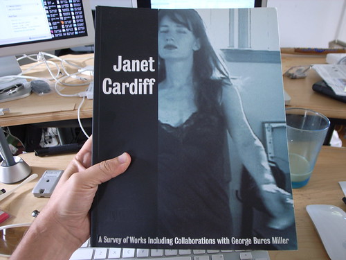
Just a quick note on some material in this hard-to-find catalogue resume of Janet Cardiff‘s work.

It’s called Janet Cardiff: A Survey of Works, with George Bures Miller

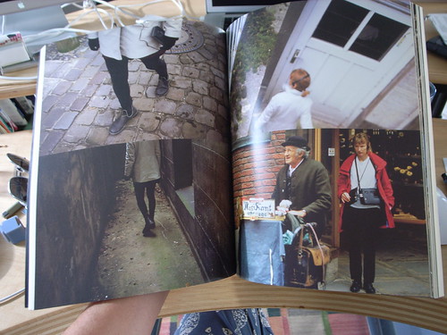
Cardiff is well-known for her early-days “sound walks” where participants were given a Walkman or similar device to listen to as they walked about. Stories were told or experiences recounted in the audio track. The idea is simple, but from what I understand (never had the pleasure..) it was the story that made the experience engaging.

I first came across Cardiff’s work while doing sort of informal background research for the PDPal project where we were trying to understand interaction in the wild — away from desks and keyboard and all that.

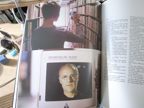
What I find curious about her work is the way it augments reality before people even really thought about all this augmented reality stuff — but, it does not fetishize little tiny screens and orientation sensing and GPS and all that. It uses our earballs rather than our eyeballs — and somehow that makes it all much less fiddly. Although — if you look carefully at the bottom image you’ll see an image from a project in which one does use a screen — from a small DV camera which is playing a movie for you as you go along.

Janet Cardiff

Parenthetically, I think Cardiff had one of the best augmented reality projects with her telescopes. I’ve only seen this as documentation when I saw Cardiff talk in Berlin at Transmediale 08. There should be more documentation of this somewhere, but the effect was to look through the telescope and see a scene in a back alley that was the back alley — only with a suspicious set of activities being committed — perhaps a crime. The illusion was in the registration but the story was in the sequence of events that one saw, effectively the story. So much augmented reality augments nothing except coupons and crap like that. There is no compelling story in much augmented reality, but I don’t follow it closely so maybe things have changed.

JCB_25072011_080858_9971
JCB_25072011_080945_9972

Continue reading Janet Cardiff Sound Art

A Curious Crosswalk Clarification

Friday January 08, 14.46.08

Friday January 08, 14.46.21

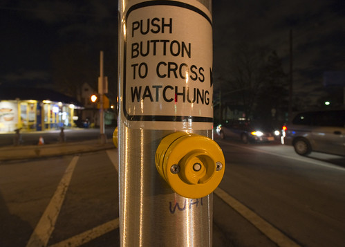
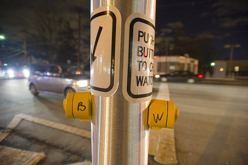
A curious inscription left by someone to clarify which button expedites which crosswalk signal. Someone has written with an indelible marker “B” and “W” on each button (for Broad Street and Watchung Avenue respectively), as well as writing an abbreviation on the pole (“WAT”, for example.) What is interesting here is that an official sign also indicates which direction is controlled by the button (“Push button to cross *arrow* Watchung”) making me wonder if this was an addition made after some complaints about the confusing buttons. What made this confusing initially was probably the fact that there are two crossings in roughly a straight line. You cross a small bit of one-lane street that subsequently does an easy turn onto Broad Street from Watchung, and then stand on this island with the buttons. Then you cross a larger street — Watchung Avenue proper — with several lanes. Approaching the island after a nervous crossing and then looking out into a daunting sea of fast-moving traffic on your way to a quick sugar fix at Holsten’s, you might think the first button you see is the one to hit, which would be wrong.

Why do I blog this? I find these sorts of thoughtful, improvised inscriptions fascinating. A different kind of “read-write” city or read-write urbanism, where people in their everyday moments take it upon themselves to make additions, hacks, DIY improvements and adjustments to make the city more livable and agreeable to their sensibilities. The points where urban design from the top-down meets urban living from the bottom-up.
Continue reading A Curious Crosswalk Clarification

Interoperability

Sunday September 20, 17.43.18

A curious interoperability protocol, wherein the address for some weird place in Seoul has been found on an iPhone and must now be entered into the GPS of the taxi. A simple affair, with minimal bumps often enough, particularly because the map on the iPhone shows the address and streets in Korean, which is great for the taxi cab driver, but miserable for the the traveler who can only hope that the locale on the map is actually where he would like to be.

Why do I blog this? This are useful moments to capture, where language, culture, objects, data come into conflict and must work their way around one another. I am told the iPhone isn’t available in South Korea at the time of this photo, so you have this foreign object — one that is probably quite legible as the iPod Touch was spotted around the city — and a baroque assemblage of devices, machines, transaction mechanisms, remote controls, identity stickers, car controls, radios, etc. I would have to contrast this with the notion of seamless perfection and interoperability that is often the image of the future transportation dashboard.
Continue reading Interoperability

Generative Urban Design

LAIsland_001

LAMap_014

Get the flash player here: http://www.adobe.com/flashplayer

var so = new SWFObject(“http://www.db798.com/pictobrowser.swf”, “PictoBrowser”, “500”, “430”, “8”, “#E0E0E0”); so.addVariable(“source”, “sets”); so.addVariable(“names”, “LA Generative Procedural Maps”); so.addVariable(“userName”, “nearfuturelab”); so.addVariable(“userId”, “73737423@N00”); so.addVariable(“ids”, “72157622074827670”); so.addVariable(“titles”, “on”); so.addVariable(“displayNotes”, “off”); so.addVariable(“thumbAutoHide”, “off”); so.addVariable(“imageSize”, “medium”); so.addVariable(“vAlign”, “mid”); so.addVariable(“vertOffset”, “0”); so.addVariable(“colorHexVar”, “E0E0E0”); so.addVariable(“initialScale”, “off”); so.addVariable(“bgAlpha”, “71”); so.write(“PictoBrowser090818080648”);

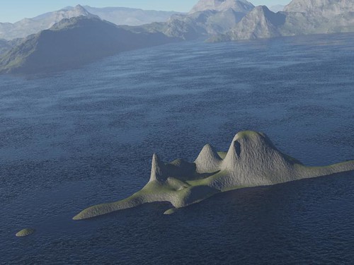
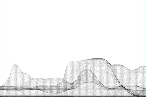
These images are from a series of generative, algorithmic sketches to describe what Los Angeles might look like as an “augmented reality.” Specifically, one view of the city from my point of view, where the topography and built environments height-density were a function of my presence. An ego city or something.

This is more an idea that has been stuck in my head and needed some expression. I am not at all sure what one does with this or how one uses it in any instrumental way except as a proper augmentation of the one canonical reality. A bit of a Kevin Lynch (Good City Form which I haven’t finished but am enjoying and, of course, The Image of the City) style map of presence, sketched from accumulated presence data rather than specifically what I imagine or how my brain conceives of urban space.

These are simple, early sketches to see how home made cartography might create density maps that reveal some sort of cartographic indication of where you have been, leaving blank or perhaps more obvious the places you have not been. Or a GPS that shows a fog-of-war map, or constructs routes for you based on a principle of exploration — routing you through areas that you have yet to see or explore.

To be continued, as always. Just curious.

Why do I blog this? But, besides that point, I am anxious to find alternative perspectives of the city, especially ones that are dynamic and produced from closer to the ground-up, rather than from the top-down. Using occupancy as a measure, or as the algorithmic seasoning seems like a Lynchian natural first step. Based on the amount of time spent in particular areas, my own personal maps should reflect this somehow, either by fogging out all the rest of the space, drawing the rest of the space as blank or, as in these sketches, altering the terrain height and the built environment’s density and building heights, etc. (Of course, these are not actual buildings from Los Angeles — it is all a thought, a sketch of these ideas. These are the things I have been thinking about, and other kinds of algorithms and/or mechanisms to materialize these ideas, such as Drift Decks, Apparatus, Personal Digital Pal’s etc.

Also, I thought I lost these sketches after complete, well-founded frustration with the absolute most crappiest piece of over-priced software I have ever come across in the whole world.
Continue reading Generative Urban Design

William H. Whyte Revisited: An Experiment With An Apparatus for Capturing Other Points of View

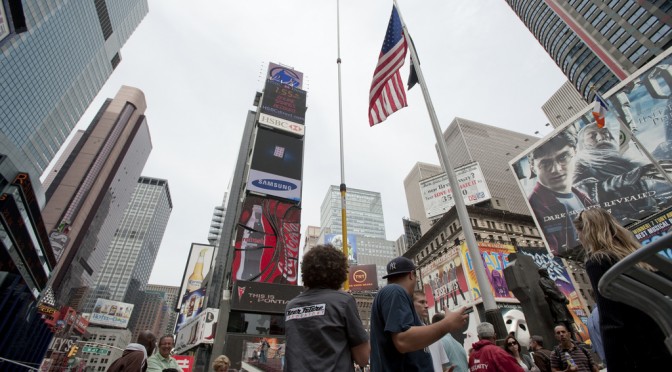
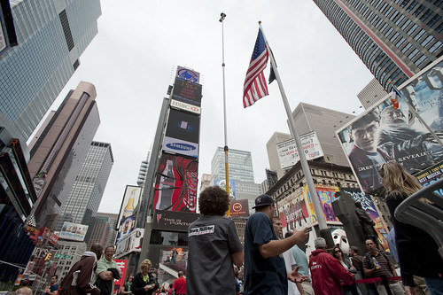
Times Square Urban Living Room from Julian Bleecker. More Apparatus Videos.

[[Update: The Apparatus was exhibited at the HABITAR show at LABoral in Gijón Spain this summer 2010.]]

A couple of months ago a colleague, Jan Chipchase, floated by my desk and handed me a book of his called “The Social Life of Small Urban Spaces” by William H. Whyte. I had no idea who this Whyte character was and I could only guess what it was about and, just by the title — I figured this would lead me down another rabbit’s hole of exploration and experimentation.

As I flipped through the pages, looking at the images of urban observations of New York City from the 1970s, I was enthralled by the technique as well as the substance of the material. Whyte and his team were capturing the intriguing, sometimes curious ways in which people adapt small corners of urban space and their habits and practices and rituals. The pace and momentum of pedestrian movement is intriguing. Without assuming anything in particular, Whyte’s work was capturing movement in a seductive way — even small scale jolts and shifts and gestures. Someone moving a chair just a small bit to indicate that he is not attempting to invade someone’s microlocal private space. You see the “fast-movers” bobbing and weaving quickly around a phalanx of slow moving tourists, window shoppers or a more elderly pedestrian.

Wonderful, intriguing stuff. Sold. Hooked. What’s the brief? Oh, what would I do? Follow footsteps and curiosities, I guess. I was curious — how can the momentum and pace and speed (or lack thereof) of the urban flows be captured, highlighted, brought into focus and revealed in such a way as to visually describe time, movement, pace, scales of speed and degrees of slowness?

There is lots to say about Whyte, I am sure. I have only begun to scratch the surface of this well-known urban sociologist, explorer, scout, observer. But, for the purposes here what happened as a result of this brief conversation with Jan was something that spread through the studio — a bout of curiosity that led to another, other project. It started simply by wondering if the observational studies that Whyte had done both in this book and in other projects could be done today? And, if so — what might they observe? What might be the questions? By what principles and assumption would small urban spaces be explored?

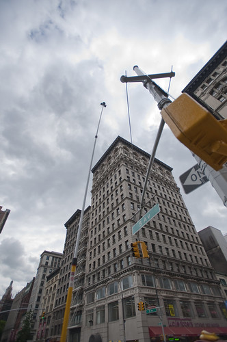
A copy of the films Whyte had made was secured in short order. Simple observations from ground level as well as from carefully chosen vantage points up high, above the ground. This intrigued me. There had been a project in the studio this time last year with things placed high for observational purposes (high chairs, periscopes, etc.) and it was filed away in the “lost projects” binder, so this seemed perhaps a way to revive that thinking. Over the course of a week, I made four trips to Home Depot, Simon jigged a prototype bracket on the CNC machine, and I had a retractable 36 foot pole that I imagined I was going to hang a heavy DSLR off of — it scared the bejeezus out of me and required two people to safely raise up. Too high, too floppy.

Another pole — 24 feet. Daunting but serviceable. It retracts to 8 feet, which is still quite high, but the range made it worth the embarrassment. After a brief bang around the reputation and suggestion networks, a wide field of view camera was identified and two ordered. Two cameras, secured to the pole produced a fair resolution, very wide field of view for displaced observations from a peculiar point of view. Good enough.

Penn Station Still Observation from Julian Bleecker on Vimeo.

Observation apparatus deployed at 7th Avenue main entrance to Pennsylvania Station, NYC, capturing ingress & egress flows, pedestrians waiting, deciding, waking up in the morning upon hitting the sidewalk, &c. The slow-scan mode highlights things which are not moving and therefore often discounted as to their import such as, for instance, the two peculiar characters to the far left who scarcely move (and were still there at the end of the day, around 7pm!), defensible space obstacles in the form of potted plants, people who wait for things, time to pass, people or taxi cabs, &c.

A notion interpreted and brought into focus by Rhys Newman.

Friday June 19, 16.17.17

15th Street and 5th Avenue, New York City.

Using some generative algorithms to show neutral zones of flow and highlighting areas of relatively stable inactivity. Somewhat mitigated by the windiness of the day which caused the cameras to move quite a bit.

Whyte was intrigued by the movement, flows, behaviors, but also emphasized the engaged observations — pen and paper, not just measurements and statistics. He was observing and analyzing both statistically — flows of people per time period over various widths of sidewalk, for example — as well capturing those things that one misses in abstracted data sets. In the film, his avuncular tone draws our attention to small curious practices. Things like someone to moving a chair in a public open space barely a few feet from where it was so as to indicate to a nearby fellow New Yorker that they were not intending to impose upon their public-privacy.

There was something about these sorts of couplings between the analytic data — numbers and so forth — and the observed, seen and demonstrated activities of people. Observed practices crafted into a kind of story about this subject — the social life of small urban spaces. Finding ways to observe and perhaps produce useful insights and design inspirations based on the observations seems a reasonable goal. There is only so much you can do with the books of abstracted data squirreled away some place before you have to go out in the world. Where I was most interested in exploring was somewhere “lower” than the high-level observations which produce intriguing visualizations but are many steps removed from the everyday, quotidian practices. Some empirical, rough-around-the-edges, observational data ethnography. A close cousin of the truly fascinating data visualizations we have grown to love. Perhaps close to Fabien’s notion of citizen sensors and citizen cartography.

We got plenty of guff with the Apparatus when we took it on the new Highline Park. One rather abrupt park minder — sort of behaving like an airline stewardess on a really bad day — was not pleased with the pole at all and let us know it. I had to talk to someone back at the offices of the "Friends of The Highline" via a cellphone given to me by a guy who was like a human surveillance entity. The woman on the phone explained – after listening to my perhaps overly analytic and historic description of the project, Whyte, &c. – that they do not allow tripods or, "you know..long poles" in the park.

Errr ahhh…

It was all very weird, and very un-appealing and put a cloud on what is a playful project, I think, but — *shrug*.

It’s all to be figured out. Or not. Perhaps its just observation. Scraps and visual thinking. Some notes in video. Constructed objects and anticipation of going mobile in Seoul and Helsinki and Linz and London. &c. Or some kind of exploration to suggest alternative ways of seeing the world around us. That may be closer to the point, at least now.

The post-processing stages of the activity are mostly explorations of ways in which individuals or small groups of people in movement could become their own producers of representations of what they do, in an aesthetic sense. What other sorts of systems might people-flows evoke or be reminiscent of? Weather patterns? Displacement grids? Where is there stillness in the bustle? Can the city’s flows be slowed down to evoke new considerations and new perspectives of what happens in the small urban spaces?

People themselves are often seen to be controlled in a top down fashion — even less insidious than “the man”, I think of the significant pedestrian operator — the “I want to cross” button at many busy intersections. It’s a point of contact with the city’s system of algorithmic, synchronized flows. But what about people as their own algorithms, by virtue of their occupancy of urban space? Not following specific top-down plans, but bottom up actions and movements. Not augmented reality but productions of realities. The center of what happens, displaced from the operational command center that articulates how the flows will operate.

I love these moments that countervene the system-wide control grids, which you can see if you watch carefully the raw footage from 15th Street and 5th Avenue where pedestrians spread themselves into the street, stretching the boundaries of the safety of the sidewalk in anticipation of the crossing. Or, perhaps something I love less but it is still something to note, a bicyclist turning the corner against traffic, possibly into pedestrians who may be less inclined to look from whence traffic should not be coming.

We push buttons to control the algorithms of the city, as in the buttons to control signals and so forth. Or roll our cars over induction loops – these are parameters to the algoithms of top-down controls over urban flows. Suppose we interceded more directly or suppose the geometry of the city were represented this way, as a product of the non-codified “algorithm” of movements.

What sort of world would this be? What would it look like?

Highlighting only things that are moving in the Union Square Farmers’ Market.

A cartesian grid distorted by flows around the Union Square Farmers Market.

Wednesday June 17, 15.04.24

Wednesday June 17, 14.44.17

Help thanks to Marcus Bleecker, Chris Woebken, Rhys Newman, Simon James, Jan Chipchase, Aaron Meyers, Noah Keating, Bella Chu, Duncan Burns, Andrew Gartrell, Nikolaj Bestle. And so on.

Videos live online and will accumulate over time. This is Times Square, NYC, Highline in Chelsea NYC, and a generative video done with Max/MSP Jitter

Street Furniture

Wednesday June 17, 15.04.24

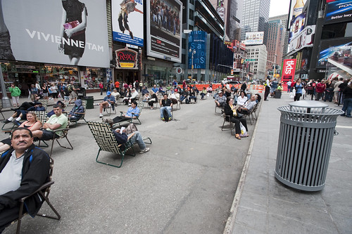
Times Square beach, complete with tourists (as any beach should), found here.

Friday June 19, 12.10.57

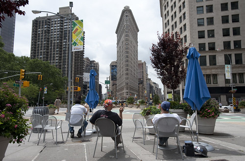
Urban Lounge found near Madison Square, New York City.

This is probably old hat for current New Yorkers certainly, and something that makes visits home really interesting, these street furnishings and people zones are incredible interventions and nice experiments about alternative urban landscaping. When arriving in Times Square with my brother for a quick screech through of High POV shots, we managed to get one of these curious middle-of-the-avenue parking spots so you basically park right smack in the middle of Times Square. Which is good because you cannot drive through the square itself, only around it, because of these pedestrian urban “beaches”, complete with lawn chairs. According to one of the local business improvement district rangers or whatever they are, tourists quite like it. I wonder if locals find these useful or an annoyance to their conveyance around the city.

Tuesday June 16, 10.28.00

Saturday April 25, 10.07.27

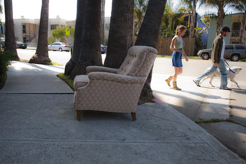
Not quite the same, but in a different category of street furniture — the dispensed with sort.

Why do I blog this? A fascinating example of a reconfiguration of the canonical gridded city. Turning pavement into a more human, habitable space that evokes other leisures is a fantastic way to create new opportunities and to think about new sorts of design practices for urban space. This is an area that many people are curious about of course, and it is something that has attracted the attention of the laboratory quite a bit recently. For some reason, we have been thinking about new kinds of principles, rituals and scouting toolkits for finding new ways to look at the city, using these to think about new kinds of interactive urbanscapes…and not interactive in the “UX” sort of digital-y way. Playful interactions, thoughtful interactions — new rules of occupancy; new social interaction rituals.