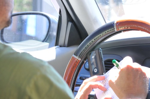
Shuttling around San Francisco in a cab, I found this intriguing set of improvised holders for a mobile phone and a bluetooth headset. California just began enforcing a law requiring that drivers use a hands-free device when they take a call while in the car. Anecdotally, we’ve seen many people continue to hold the handset to their ear while driving, and the debates continue in cocktail party conversations about whether this law makes sense. Which is more important, the physical interface between one’s driving hands and the steering wheel? Or the interface between your brain and the oftentimes cerebrally taxing levels of concentration required to watch out for, or anticipate, janky manuevers and surprises introduced by drivers/bikers/bicyclists/pedestrians/pets/bouncing balls?
Continue reading Thoughtless Acts — Improvised Holsters
Month: July 2008
Living in the Near Future
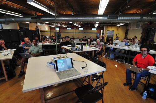
Sketching ’08 held at RISD’s Industrial Design facilities. 45 folks who, for all intents and purposes, live in the near future — doing the things that will likely become conventional in a few or five years. We convene annually to share insights, thoughts, projects and approaches to doing design, technology and art as a way to materialize their ideas.
Elizabeth Goodman has been note taking — it all starts here on her Confectious blog.
Signs of Local Pride
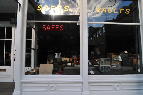
A few interesting contrasts here. This is the sort of expression of familial/local pride that seems particularly New England-y, not to mention the fascinating and huge Safe and Vault store. The contrast of material, rather than digital, protected storage is curious, and the fact that there is a store to sell vaults and such reminds us that the ephemeral world of bits and atoms still has some material anchorages, whether protecting data centers, or other material — disks or flash storage USB sticks, they are all still material objects.
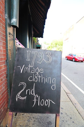
The other thing of course is the sign that a grandmother — perhaps owner of the store — has placed in the window, telling passersby that her granddaughter will be competing at the Beijing Olympics this summer. I was struck at the contrast between the pride of the grandmother and its expression in a rather rag-tag sign.
Continue reading Signs of Local Pride
Redundancies
Some curious redundancies found while on a walk-about in Providence Rhode Island.
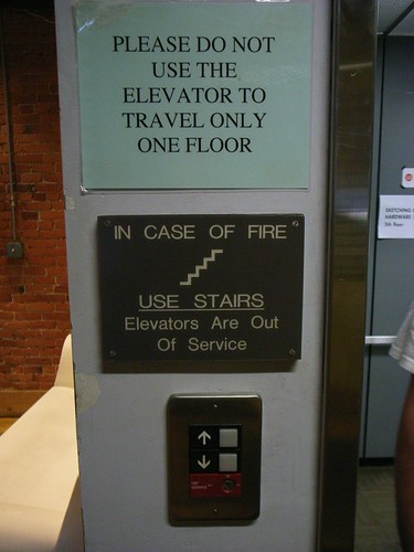
Elevator Protocols.
Urbanism, Data-Driven

(Some cartogram structures and linkages Pascal created as sensor maps where the geography is an implied and driven — rather than the driving — parameter.)
Fabien Girardin, MIT brainiac and a fellow Near Future Laboratory ‘naut presented his expert and insightful trinity of themes that appear to be the main motivators behind "urban computing", a bit of cocktail party conversation related to this short essay that Kazys Varnelis and Leah Meisterlin wrote, and that Nicolas poked a stick at.
Fabien describes three prime motivators behind the “urban computing” discussion and construction projects. Bears repeating, with some commentary.
1. Creating an opportunistic and optimistic urban environment that is somehow “better” than one without some sort of underlying computational infrastructure. This is the realm of the ubiquitous computing folks. The visions are aspirational — near-future signposts always already just out of reach and endlessly deferred — perhaps this is the definition of industry and academic R&D. Provide curious near-future fictions about possible near-future worlds. Effectively science-fiction expressed through objects and scenarios and large research (instead of film and television production) budgets. (Cf ““Resistance is Futile”: Reading Science Fiction Alongside
Ubiquitous Computing”, Paul Dourish and Genevieve Bell, forthcoming in Personal and Ubiquitous Computing.)2. Study of the impacts and implications of computational systems and operations in an urban context, performed by GIS folk and urban planners and computer science people. These are studies of the dynamics of data-people sensed in the city, mapped and used to develop insights on urban conditions, or perhaps used as contributing information for design or re-design of urban geography. In some cases the data is interpreted in real-time, such as you might expect to be done to manage loads on cellular data networks, etc.
3. The action, postulating and creative exercises of independent and undisciplinary explorers and adventurers who shuffle and interleave the interesting data points that are anchored to geographies that can be re-mapped. This has brought us such interesting tidbits as the various crime data maps, for example, or the flows of automobiles throughout cities. (Using the geeky, horribly, self-deprecatingly named “mash-ups”.) What is happening here that is most compelling to me at least is that “GIS” activities are becoming something that anyone, without a license or professional sanction can do, inexpensively (i.e. for free and a bit of time). So, anything new here and worth glorifying is this fact — we can be our own map-makers. This is significant in the Foucauldian power-knowledge sense of significant. Cartograms such as the fundraising maps, which started out as a very DIY project, are important because they create new meaning and possibilities for action, or shifts in perspective that can lead to change, rather than stagnation. (There’s a normative element, of course. Visualizations of data with geographies, in the power-knowledge realm of things, are as free to interpretation as anything that alleges to be fact, so they can’t be counted upon to prove much of anything. At worst, they can be enrolled in larger conversations, just like any good knowledge agent.)
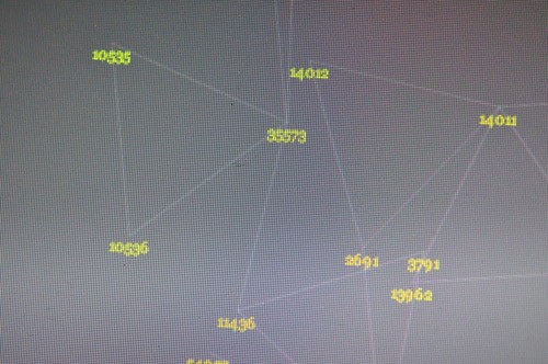
(Some more of Pascal’s cartogram structures and linkages. Sensor maps recorded amongst a small group of us and visualized such that the geography is an implied and driven — rather than the driving — parameter.)
I’d add a bit here. How can the experience of space — urban space, just to stick to the most discussed idiom — become fruitfully and playfully data-driven? Mapping data onto geographies by their instrumentalized location in space is okay. It’s a bit knee-jerk, though. What I mean is that re-mapping data with an entirely different basis could possibly produce an entirely different urban experience that may, at worst, be curious and playful. Just to see what comes of this. The Laboratory has been working for way too long on such re-mappings that do not assume that latitude and longitude are the canonical reference points for whatever data gets built on top.
I know..I know. This is weird. And the first project I was involved with that did this — an edition of PDPal that created maps based exclusively on interpreting an “experience” — fought a losing battle. But there are some indicators that this approach is at least worth exploring.
Creating “maps” that have a spatial aspect to them, but that do not use space as the primary or explicit reference datum can then emphasize people-practices or experiences first, with the geographic datum implicit or made into a driven, rather than driving, parameter. Paulos and Goodman’s “Jabberwocky” project comes to mind, as do Twitchr and other mappings of “encounters” and actions that are not expecting to use GPS first-and-foremost.
Situationist Space (Thomas F. McDonough)
Here in the Laboratory we’ve been building several prototype devices that record Bluetooth encounters for later visualization. The first prototype was a small Python script running on a Nokia N70 phone. It was like a little data attractor that would sniff for Bluetooth devices, and then record them in a log file, and send them to a server to be persisted in a database.
Two recent editions used a small, custom-designed device that used the Bluetooth scanning mode of a radio to essentially do the same thing, storing the results in a Flash memory device to be later extracted with a simple USB interface. Lately a bunch of us in the studio have been working with a similar concept in the form of a background sensing application developed at Nokia R&D for S60 devices that does all of this, plus quite a bit more. (Currently in closed alpha, but soon to be available publicly.) The biggest challenge (besides running it on an S60 device..) is making meaning out of all of this. The strongest vectors for me, at least, lead to re-mapping and exploring possibilities playfully, with no specific expectations that there is intelligence in the maps by themselves.
# install first the following files to your phone
# (they will install automatically the needed libraries for the script below):
# aosocket-series60_v20.sis, pdis.sis
# found at: http://pdis.hiit.fi/pdis/download/pdis/

# this script was found from forum.nokia.com

import e32
import appuifw
##import aosocketnativenew
from pdis.lib.logging import *
##import httplib, urllib
from location import gsm_location
import time
import sysinfo
import select

cell = []
init_logging(FileLogger("e:\apache\htdocs\bt_probing.html"))

def tell(string):
    #logwrite(string)
    if e32.is_ui_thread():
        print string
        e32.ao_yield()

# ----------------------------------
from aosocket.symbian.bt_device_discoverer import *
#from socket import * # for obex file send

def discovered(error, devices, cb_param):
    if error == 0:
        global cell
        #tell("start discovery..")
        cell = gsm_location()

        #tell("devices: " + str(devices))
        tell(cell)
        #print location.gsm_location()
        for address, name in devices:
            logwrite("")

            tell(cell[0])
            tell(cell[1])
            tell(cell[2])
            tell(cell[3])
            print location.gsm_location()
            urllib.urlopen("http://smalltown.nearfuturelaboratory.com/upload_bt.jsp",
                           urllib.urlencode([('addr',address),('name',name),
                                             ('imei', sysinfo.imei()),
                                             ('batt', sysinfo.battery()),
                                             ('signal', sysinfo.signal()),
                                             ('cell_0', cell[0]), ('cell_1', cell[1]),
                                             ('cell_2', cell[2]), ('cell_3', cell[3])]))
    else:
        tell("device discovery failure: error %d" % error)
    _discoverer.close()


# -----------------------------------------------------------------------------


while(1):
    try:
        _discoverer = BtDeviceLister()
        _discoverer.discover_all(discovered, None)
        #tell("discovering")
        e32.ao_sleep(15)
        print "scanning again"
    except:
        tell("init failure")
        appuifw.note(u"Fatal error.", "error")
Eliasson
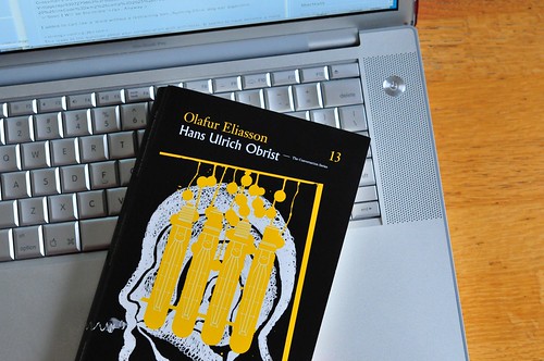
Further to Chris’ post — I found Hans Ulrich Obrist & Olafur Eliasson: The Conversation Series to be last week’s best quick-read. (Actually, I guess it was last’s weeks only quick-read, if I don’t count reading 1/2 of Austin Grossman’s cleverly sardonic “Soon I Will be Invincible”. Anyway.)
I added-to-cart like a ‘droid without a restraining bolt..So, running Chris’ dog-ear algorithm..
p.36
This leads to the question about your collaboration with architects. It seems to have become a more important aspect of your work recently.
..In the same way that artistic practice has rediscovered its ability to constantly re-evaluate its own platform, architectural discourses have opened up a bit, engaging in matters other than their own formal setup. This is why including architects — and engineers or scientists — is crucial for bringing me to places I couldn’t reach on my own.
p.52
Let’s talk about public art.
..When you show in a gallery, you’re quite concerned with what came before and what will follow in the gallery program because there’s certain overlap in ideology. So if the shows before and after yours are nonsense, then your show takes on that agenda, whether you like it or not. The case is different with public art because, like architecture, it has been extensively compromised. But I see a great potential for art in public space because theres always the possibilit that people might not rrealize that it’s art. It’s as simple as that. People might enter a plaza and think a piece is something functional or something they don’t understand, but it’s there. And that intrigues me — the fact that such pieces are not immediately recognizable as art.
p.58
..I’d like to ask you about an edition projects of yours I once saw the beginnings of. The was to map the whole of Iceland using found images
..The Icelandic Cartographic Institute used photos to make maps of the country…They photographed the whole country from aboe by plane. And these photos were made with an unusually good photographic system. What’s interesting about this, besides the idea of mapping things completely, is that we are now in an era of satellite images, so aerial photography has disappeared..the airplane is only one kilometer up in the sky and that means that the view of one squar kilometer of ground is completely different than the view from a satellite, which is 600 kilometers high. There’s a spatial issue an airplane photo deals with that a satellite photo doesn’t have to deal with. A satellite photo involves another coneption of cartography; this is quite interesting because our eyes and the way we relate to space are in a limbo between aerial and satellite perspectives.
p. 62
..the idea of a “parliament of things” is something I’ve also engaged with through a text by Bruno Latour that he wrote while preparing for his exhibition Making Things Public..in which he describes the idea that all things are relative and to be debated and evaluated. I like this, and it’s something I’ve focused on in much of my work — the notion that we all perceive things differently even though we’re engaging with identical physical objects or environments. For Latour, it’s not a question of universal rules that would define things, but an emphasis on negotiation.
p. 73What about specific projects of yours in relation to the urban situation?
Yes, through the idea of an unbuilt city, I’ve slowly realized how all of my work forms a sort of spatial language. I’m also developing this idea of how to construct and deconstruct at the same time: you can say something and both evaluate and critique it simultaneously, like in an endless loop.
p. 75My last question is about the inadequacy of some of today’s museums that become less and less experimental
..Currently artists are obsessed with dematerializing, recontextualizing, or reevaluating the object. I’m referring to the whole disappearance of the object and everything now being based on relations — the quasi-object. That’s not a problem in itself, but unfortunately museums are moving in the wrong direction. Their approach to it remains highly conservative: they’re trying to institutionalize the object — and not just the object’s physical qualities, but the experience of it. In fact, museums tend to commodify, or at least objectify, the experience of the object. And as this is played out, they narrow down the way the public sees things. To be frank, I think they’ve become producers of “seeing-machines”; they not only produce the art, but they dictate the way art is to be seen thanks to their event-driven and conservative perspectives on the object. So they’re losing the socializing potential of art..
p. 88
The reason I do these interviews is to learn more myself; it’s a way of saying to people that I’m not the mastermind of the project, at least not in the classic genius kind of way. There’s no reason to pretend that I’m doing this all by mself; I’m going to involve various people in the project.
p. 100
The next question is about the micro and macro aspects of landscapes. I know that you maintain this ongoing project of attempting to photograph the entire topology of Iceland — a mapping project..
One aspct about my excitement with this project is that it constantly varies, it changes a lot. To cover and document the whole surface of Iceland is actually more about the impossibility of creating an objective map … but equally about how cartography has fostered a third-person point of view on our inhabited space. At some point, for instance, maps began to be so precise that one could actually relate to them as a kind of time dimension, enabling us to say: “From here to Rome is a half year on horse-back.” A map thus also became like a clock, a temporal calibration. So in my project the idea of mapping everything from the air, documenting minutiae, all the glaciers, all the waterfalls, the crevasses, the routes, curved roads and straight roads, all these mappings serve to destabilize our usual conception of time. When documenting things, you also apply a new dimension to them; I apply what we talked about before — the different ideas of space — and question the dimensionality of things.
p.110
The weather is one of the few really public domains..we might say that the weather is in a constant dialogue with the landscape..if it rains, it becomes completely black and shiny; if it’s super-dry or if there’s a sandstorm, it changes color; and if the sun is radiant, the glacial melt is so intense that the rivers rise enormousl. So the landscape and the weather function as an ensemble and your body is reciprocally isolated.
p. 131
The idea is to establish an interdisciplinary school that focuses on spatial issues. It will do so primarily from the perspective of art and artists, but it should also have a group of architects and perhaps several scientists working on, for instance, psychophysical issues. The school should offer some sort of post-graduate degree; I think it would be nice to have a group of PhD candidates affiliated with it..In other words, the school is not about producing artists in the traditional sense, but about introducing a vocabulary through which artworks can become much more integrated into society, social structures, and scientific and architectural discourses.
Einar's "Adventures in Urban Computing"
Einar Sneve Martinussen reports on the completion of his thesis project "Adventures in Urban Computing" from the Oslo School of Architecture and Design. I’ve been peripherally following his work ever since we first met when I was at the AHO for a NordiCHI workshop on near-field communication.
Einar describes the project this way:
This diploma project is an expedition into urban computing, an emerging multi-disciplinary research field that focuses on computing and digital networks in urban contexts and on the cultural and social impact this has on the city..The first half of the project is a theoretical approach to the field where urban computing is placed, traced and discussed within a framework of current writings on ubiquitous computing, urban studies, technology and design. The second part of the diploma is a set of practical explorations The second part of the diploma is a set of practical explorations that take these reflections as its starting point. These explorations investigates how mobile devices can be used to gather and provoke opinions about the city and how this can raise the awareness of daily urban environments. They focuses on how digital networks and information technologies can be used in collaborative city studies and in strategies/concepts for citizen participation. The outcome of these studies is the Interruptor experiments.
The Interruptor is a curious device, one we should see more of, that turns distraction into moments of and opportunities for observation and participation with the city. What I find intriguing is the integration of a designed object to express his insights and thoughts related to the underlying “theory” that he excavates in the first section of the thesis paper, a point that I think is crucial to the best kind of undisciplinary design.
Continue reading Einar's "Adventures in Urban Computing"
iPhone for Hertzian Space
Architecture is the simplest means of articulating time and space, of modulating reality and engendering dreams…The architecture of tomorrow will be a means of modifying present conceptions of time and space. It will be both a means of knowledge and a means of action. Architectural complexes will be modifiable. Their appearance will change totally or partially in accordance with the will of their inhabitants.
Formulary for a New Urbanism, Ivan Chtcheglov, 1953, from Situationist International Anthology, Ken Knabb editor.
I’m no theorist of space, architecture, and digital media — there are plenty of bright ones about. What I’m curious about are the material choices available to the design and construction of spaces that are modifiable by their inhabitants. What are the ways that time and space — the key elements for bounding and warping habitats — will be “architected” by the time and location-based activities of digital devices?
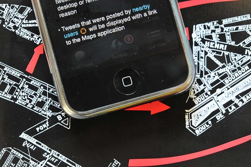
"Locative Media" is the term that was (once) used to describe media that is digitally marked with some location correlation. In the most primordial example, a photograph is inscribed with the location from where it was taken. Now, we see these sorts of weak-signals leaking into all kinds of (somewhat anticipated, eagerly accepted) “tagging” of many new and curious forms of digital-social expression. What does it mean to find out that someone is Twittering near me? Continue reading iPhone for Hertzian Space
PSX (With Propeller) — Digital Edition
So, feels just a little bit like converting religions or something, but I’ve started looking into other kinds of microcontrollers for practical reasons as well as to just generally expand what sits in my prototyping sketchpad. I’ve been curious about the Parallax Propeller, which has a multi-processor (they call them “Cogs”) core and can do video and audio gymnastics. It uses its own proprietary language called “Spin” which is pretty legible if you’ve done any high level programming. Assembly is also an option. The idea of having a small “microcontroller” that has built in multi-processor capabilities feels a bit over-blown, but it’s actually fairly liberating in the design phase. Suddenly, projects start to look like parallel tasks that can be designed with object-oriented sensibilities in mind. All of the “task switching” (cog switching) is handled automatically. Timing and so forth is fairly static so it’s possible to predict precisely how often tasks will get run. The Propeller will also run wickedly fast — way faster than an Atmel 8-bit microcontroller. Normally, speed hasn’t been an issue for projects, but it’s nice to have some overhead — up to 80 MHz in this case (versus 20 MHz for the Atmel, which is more then enough for most things, but the lickity-split clock makes doing embedded video projects possible.
Anyway, this seemed like a good possible fit for the PSX project because I need to simultaneously read a joystick and service polling requests from the console. I probably _could_ do both of these tasks with an Atmel microcontroller running at 20 MHz, interrogating the controller in between the console’s polling. Experience thus far has led me to think that this may not be the easiest thing to do, even sequentially. I’ve tried just servicing the console using the built-in SPI hardware in an Atmel 8-bit microcontroller and the timing is a bit flakey. Perhaps someone with a little more expertise in these things could take this on.
[ad#ad-1]
In the meantime, I went for a few extra cylinders and some more octane, which works better than well-enough.
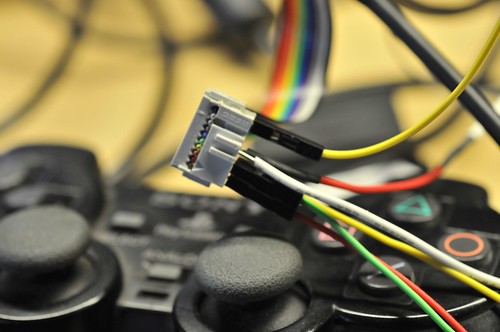
I found some code that Micah Dowty put together for a Playstation project called Unicone. He had some code there in the midst of that project that was easily adapted to my weird PSX controller-that-gets-tired project.. Works like a charm.
I can specify the data that’ll go across the wire very simply, as a pointer to a buffer of data and Dowty’s object takes care of all the rough-stuff communication to the console. I can even specify what kind of controller I’m emulating, if I want. What’s left is to create an object that polls the real controller, makes some decisions about how “tired” it should be and changes the analog control stick values based on that tiredness and places this data in the buffer. Because the Propeller’s “Cogs” can share data, this should be pretty easy..
This is a trace of communication when I use the code below. The buffer is sent across just as it is, and Dowty’s object is smart enough to send it as if it were a simple PSX analog joystick N.B. the first two bytes after 0xFF, 0x73, 0x5A pre-amble are the button settings, as a 16 bit word, followed by four bytes representing the analog joystick positions. In the DAT section of the code at the very bottom of the listing below, this is exactly what I want sent. Simple.


