“To cover the world, to cross it in every direction, will only ever be to know a few square meters of it… tiny incursions into disembodied vestiges, small incidental excitements, improbable quests congealed in a mawkish haze a few details of which will remain in our memory. And with these, the sense of the worldís concreteness…no longer as a journey having constantly to be remade, nor the illusion of a conquest, but as the rediscovery of a meaning, the perceiving that the earth is a form of writing, a geography of which we had forgotten that we ourselves are the authors.”
– Georges Perec, Species of Spaces
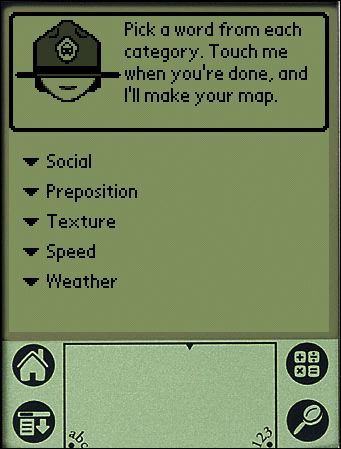
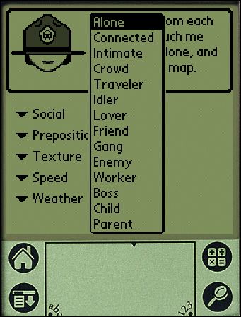
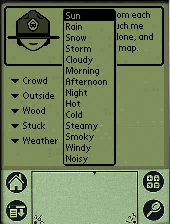
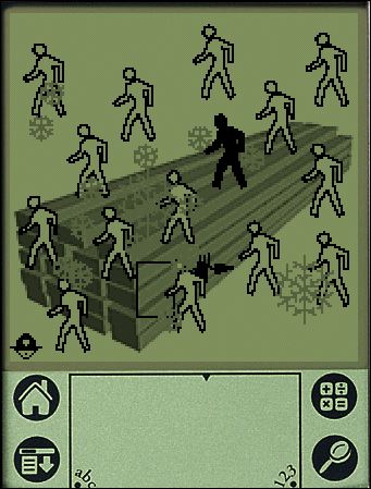
PDPal was a series of public art projects for the Palm™ PDA, mobile phone and the web. It has pushed at the notion of mapping, attempting to transform your everyday activities and urban experiences into a dynamic city that you write. PDPal engages the user through a visual transformation that is meant to highlight the way technologies that locate and orient are often static and without reference to the lively nature of urban cultural environments.
Your own city is the city composed of the places you live, play, work, and remember. Itís made of the routes and paths through which you make connections. Your city is also about the meanings you ascribe to the places you inhabit, pass through, love or hate. You imagine those places and routes as more than a street address, or directions you may give. These places have vivid, metaphorical meanings and histories that PDPal allows you to capture and visualize imaginatively, effectively writing your imaginary city.
In response to the plethora of mapping projects that have utilized GPS and measurable cartography, PDPal has been anti-geographic and anti-cartesian, preferring to experiment with the construction of relative, emotionally based systems that ask: what makes social or personal space. PDPal responds to the century-old idea of the urban explorer: from Baudelaire’s “flaneur” (late 19th c); the Dadaists’ public performances of nothing, sometimes called “deambulations” (1921); Benjamin’s texts on the urban wanderer (1920’s); the Situationists’ algorithmic “derives”; Hakim Bey’s “Temporary Autonomous Zones” that spring up in the cracks of urban regulations, and are opportunities for brief piracy of a place; and contemporary work in psychogeography – all deliberate projects of “getting lost” in the city, thus restoring it to a great dense space of wonder, not just a locus of labors.
EXHIBITION HISTORY
Eyebeam Atelier, NYC “Beta Launch” show and artists’ residency 2002
Walker Art Center, Minneapolis, MN 2003
Transmediale Festival, Berlin 2003
University of Minnesota Design Institute, “Twin Cities Knowledge Maps” 2003
Times Square, NYC “Creative Time Presents” 2003-2004
Whitney Museum of American Art, Artport 2003
Walter Phillips Gallery, The Banff Centre, Alberta Canada “Database Imaginary” 2004
MoMA, Online “Talk to Me” exhibit 2011
It’s hard to describe just with words — so here are platform emulators for the PDPal v1 that will run on a Windows machine and a Macintosh.
Here you can download a zip file of a Palm Pilot Emulation of PDPal Eyebeam Edition.
Here is the PDPal — Macintosh “Desktop” Emulator. (It’s a DMG file (mountable disk file). The README file explains the three simple steps you need to take to make it all work.)
Why do I blog this? I was thinking recently about the possibilities for mapping built environments, like cities, asynchronous — out of synchronization — with traditional “grounded” coordinates. What does the world look like when it is “un-hooked” from the earthly systems of synchronizing physical locations. If latitudes and longitudes suddenly up and floated away from us, what means would arise for coordinating our place in space? For example, for the Smalltown project, the exercise is to coordinate movement through space based not on latitude/longitude, but on the existence of Bluetooth identification beacons floating in space. If we closed our eyes, and had no GPS and could only determine our place based on unfixed beacons, what would that experience be like? And what way of looking sideways at the world would it evoke? How would it force new perspectives and new ideas for inhabiting the world?
PDPal was very much motivated from this perspective. One of the main challenges was connecting the notion of mapping to this PDA application. PDAs at the time were gadgets for people with jobs and a sense of urgency about managing the minutiae of their lives. The idea of geographically uncoordinated maps, and maps coordinated by these five peculiar categories was antithetical to the sensibilities of PDA owners. It was a cute art project, but much less a provocation. It was a fantastic project, that ultimately had three solid commissions.
Technorati Tags: art technology
Related
Creative Time, 59th Minute
PDPal, Times Square Edition
Denis Wood Essay on PDPal
PDPal at the Walker Art Center
Marina’s PDPal page