var so = new SWFObject(“http://www.db798.com/pictobrowser.swf”, “PictoBrowser”, “500”, “430”, “8”, “#E0E0E0”); so.addVariable(“source”, “sets”); so.addVariable(“names”, “LA Generative Procedural Maps”); so.addVariable(“userName”, “nearfuturelab”); so.addVariable(“userId”, “73737423@N00”); so.addVariable(“ids”, “72157622074827670”); so.addVariable(“titles”, “on”); so.addVariable(“displayNotes”, “off”); so.addVariable(“thumbAutoHide”, “off”); so.addVariable(“imageSize”, “medium”); so.addVariable(“vAlign”, “mid”); so.addVariable(“vertOffset”, “0”); so.addVariable(“colorHexVar”, “E0E0E0”); so.addVariable(“initialScale”, “off”); so.addVariable(“bgAlpha”, “71”); so.write(“PictoBrowser090818080648”);
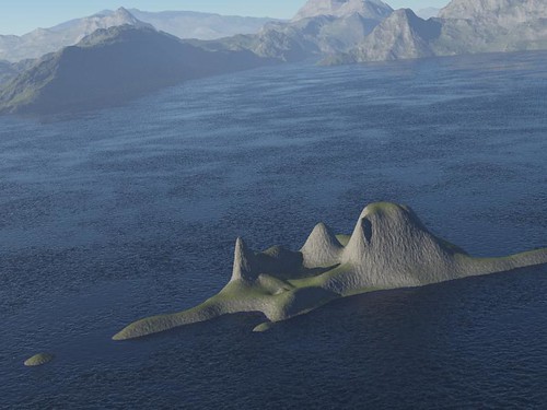
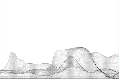
These images are from a series of generative, algorithmic sketches to describe what Los Angeles might look like as an “augmented reality.” Specifically, one view of the city from my point of view, where the topography and built environments height-density were a function of my presence. An ego city or something.
This is more an idea that has been stuck in my head and needed some expression. I am not at all sure what one does with this or how one uses it in any instrumental way except as a proper augmentation of the one canonical reality. A bit of a Kevin Lynch (Good City Form which I haven’t finished but am enjoying and, of course, The Image of the City
) style map of presence, sketched from accumulated presence data rather than specifically what I imagine or how my brain conceives of urban space.
These are simple, early sketches to see how home made cartography might create density maps that reveal some sort of cartographic indication of where you have been, leaving blank or perhaps more obvious the places you have not been. Or a GPS that shows a fog-of-war map, or constructs routes for you based on a principle of exploration — routing you through areas that you have yet to see or explore.
To be continued, as always. Just curious.
Why do I blog this? But, besides that point, I am anxious to find alternative perspectives of the city, especially ones that are dynamic and produced from closer to the ground-up, rather than from the top-down. Using occupancy as a measure, or as the algorithmic seasoning seems like a Lynchian natural first step. Based on the amount of time spent in particular areas, my own personal maps should reflect this somehow, either by fogging out all the rest of the space, drawing the rest of the space as blank or, as in these sketches, altering the terrain height and the built environment’s density and building heights, etc. (Of course, these are not actual buildings from Los Angeles — it is all a thought, a sketch of these ideas. These are the things I have been thinking about, and other kinds of algorithms and/or mechanisms to materialize these ideas, such as Drift Decks, Apparatus, Personal Digital Pal’s etc.
Also, I thought I lost these sketches after complete, well-founded frustration with the absolute most crappiest piece of over-priced software I have ever come across in the whole world.
Continue reading Generative Urban Design